mail_outline sales@mediastorehouse.com
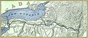
Erie Canal routeMap of the Erie Canal across New York state, 1800s. Hand-colored woodcut of a 19th-century illustration
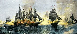
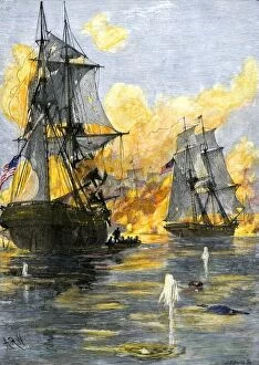
Battle of Lake Erie, War of 1812British and American ships engaged in the Battle of Lake Erie, 1813. Hand-colored woodcut of a 19th-century illustration
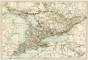
Ontario, 1870sMap of Ontario, Canada, 1870s. Printed color lithograph
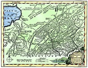
Colonial Pennsylvania map, 1750sMap of the " Province of Pennsilvania, " 1756. Hand-colored 19th-century woodcut reproduction of an 18th-century illustration
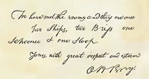
EVNT2A-00196Oliver H. Perrys note proclaiming his Lake Erie victory: " We have met the enemy and they are ours." Woodcut with watercolor wash
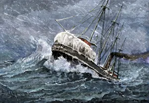
Lake Erie grain boat in a snowstormSteamship carrying grain on Lake Erie in a snowstorm, headed for Buffalo, New York, 1880s. Hand-colored woodcut of a 19th-century illustration
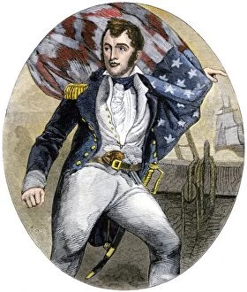
PNAV2A-00002US Navy Commander Oliver Hazard Perry during the Battle of Lake Erie, War of 1812. Hand-colored woodcut of a 19th-century illustratioin
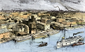
Entrance to the Erie Canal at Buffalo, New York, 1880sLake Erie freighters and Erie Canal barges along the waterfront of Buffalo, New York, 1880s. Hand-colored woodcut of a 19th-century illustration
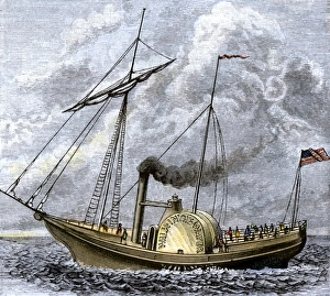
Walk-in-the-Water steamboat on Lake Erie, 1818Lake Erie steamboat " Walk-in-the-Water, " 1818. Hand-colored woodcut of a 19th-century illustration
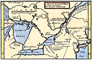
French map of the Great Lakes, 1703La Hontans map of the Great Lakes and Saint Lawrence valley, 1703. Hand-colored 19th-century woodcut reproduction of an 18th century illustration
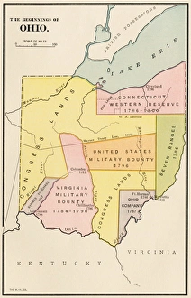
Ohios early land divisionsLand division and early settlements in Ohio Territory. Printed color lithograph of a 19th-century illustration
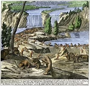
EXPL2A-00356Beavers at work below Niagara Falls, early 1700s. Hand-colored woodcut from Molls New and Exact Map
EVNT2A-00013US fleet of Oliver H Perry during his naval victory over the British on Lake Erie in 1813 during the War of 1812. Hand-colored woodcut of a 19th century illustration
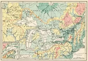
EXPL2A-00357Map of the Great Lakes and the St. Lawrence watershed. Printed color lithograph, 19th century