mail_outline sales@mediastorehouse.com
PMYT2A-00017King Arthur receiving his magic sword from the Lady of the Lake. Hand-colored woodcut of a 19th-century illustration
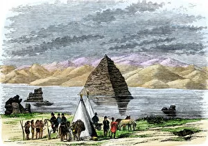
EXPL2A-00169John C. Fremonts second western expedition at Pyramid Lake, Nevada, 1842-1843. Hand-colored woodcut of a 19th-century illustration
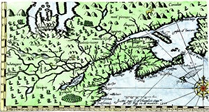
EXPL2A-00184Part of the 1613 Samuel de Champlain map of New France. Hand-colored woodcut of a 19th-century reproduction of the original ma
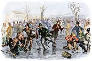
A crowded Boston skating pond, 1800sA skating scene in Boston, Massachusetts, 1850s. Hand-colored woodcut of a 19th-century illustration
HREC2A-00020Skating on a pond in winter, 1800s. Hand-colored woodcut of a 19th-century illustration
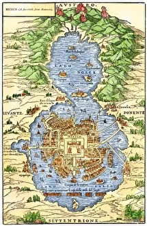
EXPL2A-00294Tenochtitlan, capital city of Aztec Mexico, an Island connected by causeways to land, 1520s. Hand-colored 19th-century woodcut reproduction of an early Spanish colonial map
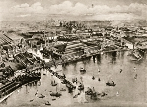
Chicagos Columbian Exposition, 1893Birds eye view of the Columbian Exposition, Chicago, 1893. Albertype reproduction of an illustration
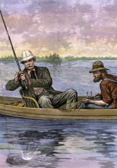
President Arthur fishing on a remote lakePresident Chester A. Arthur on a fishing trip, 1884. Hand-colored woodcut of a 19th century illustration
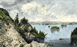
Native American canoe on Lake ChamplainLake Champlain before the arrival of European settlers. Hand-colored woodcut of a 19th-century illustration
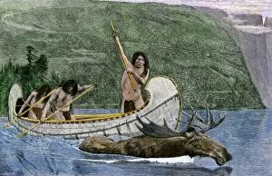
NATI2A-00135Native Americans in a canoe hunting a moose. Hand-colored woodcut of a 19th-century illustration
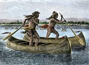
NATI2A-00136Native Americans racing in canoes. Hand-colored woodcut of a 19th-century illustration
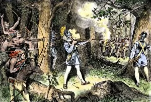
EXPL2A-00186Samuel de Champlain and his Huron Indian allies fighting the Iroquois near Lake Champlain, 1609. Hand-colored woodcut of a 19th-century illustration
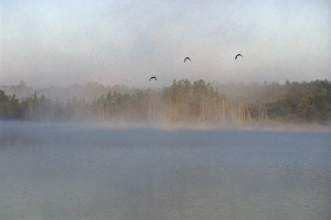
Mallards over the Wolf River, WisconsinWild ducks in morning fog flying over Post Lake on the Wolf River, Wisconsin. Photograph
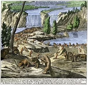
EXPL2A-00356Beavers at work below Niagara Falls, early 1700s. Hand-colored woodcut from Molls New and Exact Map
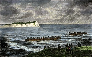
Sir Richard Burton exploring Lake Tanganika, 1858Sir Richard Burton exploring Lake Tanganika, east Africa, 1858. Hand-colored woodcut of a 19th-century illustration
Fort Ticonderoga about 1850Ruins of Fort Ticonderoga on Lake Champlain, about 1850. Hand-colored engraving of a 19th-century illustration
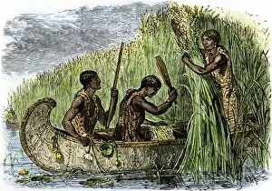
NATI2A-00199Native American women gathering wild rice by threshing it into their canoe. Hand-colored woodcut of a 19th-century illustration
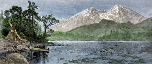
Colorado Rockies home of a Native AmericanNative American tipi and canoe on the shore of lake beneath Longs Peak, Colorado. Hand-colored woodcut of a 19th-century illustration
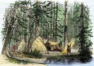
NATI2A-00139Native American lodges and their birch-bark canoe in Canadian forest. Hand-colored woodcut of a 19th-century illustration
NATI2A-00049Native American and his canoe beside Silver Cascade on the shore of Lake Superior, 1800s. Hand-colored woodcut of a 19th-century illustration
NATI2A-00055Native American buffalo-skin tipi and birchbark lodge, Lake of the Woods, Minnesota, early 1800s. Hand-colored woodcut of a 19th century illustration
NATI2A-00042Native American women gathering wild rice in baskets. Hand-colored woodcut of a 19th-century illustration
NATI2A-00035Native American fishing in a birchbark canoe. Printed halftone reproduction of an illustration by N.C. Wyeth
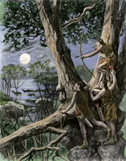
NATI2A-00010Native Americans bow-hunting deer by moonlight. Hand-colored photogravure of a 19th-century illustration
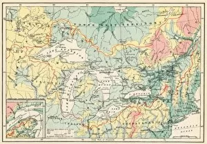
EXPL2A-00357Map of the Great Lakes and the St. Lawrence watershed. Printed color lithograph, 19th century
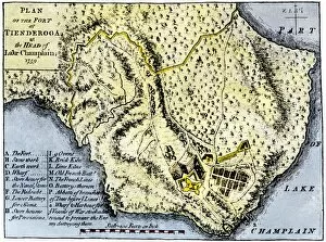
EVNT2A-00209Map of Fort Ticonderoga in 1759, during the French and Indian War. Hand-colored printed halftone reproduced in the 19th century
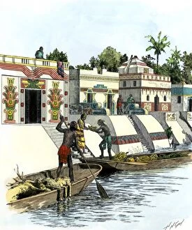
NATL2A-00003Aztec merchants on a canal in Tenochtitlan before the Spanish conquest. Hand-colored woodcut of a 19th-century illustration
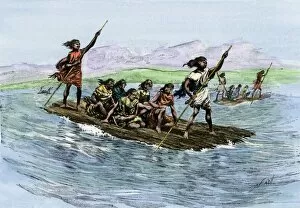
NATL2A-00027Balsas, or native rafts, on Lake Titicaca in the Andes Mountains. Hand-colored woodcut of a 19th-century illustration
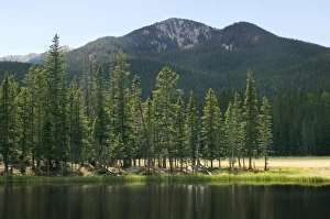
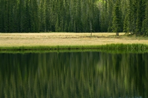
Pecos Wilderness, New MexicoHigh glacial lake in the Pecos Wilderness, Sangre de Cristo Mountains, New Mexico. Digital photograph
Pecos Wilderness lake, New MexicoGlacial lake in the Pecos Wilderness, Sangre de Cristo Mountains, New Mexico. Digital photograph
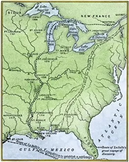
EXPL2A-00171Map showing the route of La Salles explorations in North America, late 1600s. Hand-colored woodcut of a 19th-century illustration
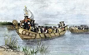
PEXP2A-00026Antoine de La Mothe, Sieur de Cadillac landing on the shore of Lake Saint Clair where he founded Fort Detroit, 1701. Hand colored woodcut of a 19th-century illustration by Howard Pyle