mail_outline sales@mediastorehouse.com
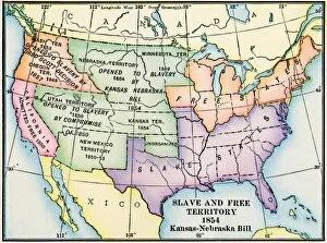
EXPL2A-00312Map of slave and free areas of the United States in 1854, at the time of the Kansas-Nebraska Bill. Printed color lithograph 19th century
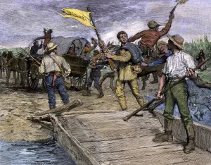
Proslavery voters invading Kansas, 1850sPro-slavery forces ferrying Missouri voters to the Kansas shore to vote against free soil, 1850s. Hand-colored woodcut of a 19th-century illustration