mail_outline sales@mediastorehouse.com
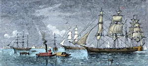
Seaport of Galveston, Texas, 1800sGalveston bar and roadstead on the Gulf Coast, 1870s. Hand-colored woodcut of a 19th-century illustration
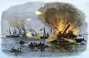
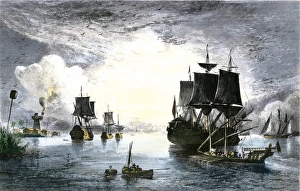
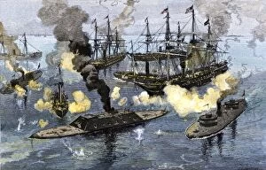
Union gunboats sunk in Galveston Bay, 1863Rebel attack on Union gunboats at Galveston, Texas, 1863. Hand-colored woodcut of a 19th-century illustration
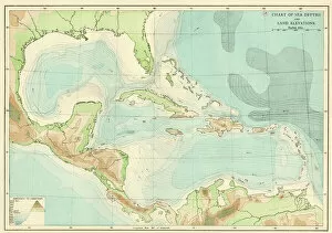
EXPL2A-00377Chart of the West Indies sea depths and land elevations. Printed color lithograph of a 19th-century illustration
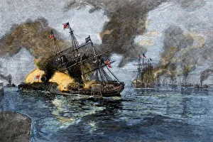
Battle of Mobile Bay, Civil War, 1864Farraguts flagship USS " Hartford" colliding with the ironclad CSS " Tennessee" to secure Mobile Bay, 1864. Hand-colored woodcut of a 19th-century illustration
Ships entering the Mississippi River from the Gulf of Mexico, 1700sSailing ships at the mouth of the Mississippi River in the late 1700s. Hand-colored engraving of a 19th-century illustration
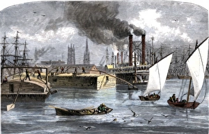
Busy New Orleans waterfront, late 1800sSteamboats and barges on the Mississippi River at New Orleans, circa 1880. Hand-colored woodcut of a 19th-century illustration
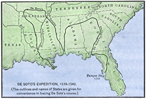
Map of DeSotos route, 1540sDe Soto expeditions route across southeast North America, 1539-1542. Hand-colored woodcut of a 19th-century illustration
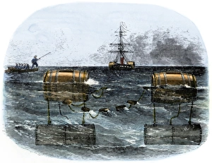
Confederate explosive mines blocking a river, Civil WarBarrel torpedo, or mine, used by Confederates to blockade a southern river mouth, 1860s. Hand-colored woodcut of a 19th-century illustration
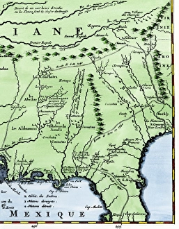
Map of part of DeSotos route, 1500sEastern portion of De Sotos route across southeastern North America, 1500s. Hand-colored woodcut reproduction of a 1593 illustration
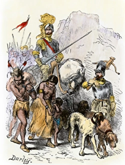
DeSoto with Native American captives, 1539De Soto expedition traveling with captive Native Americans, 1539. Hand-colored woodcut reproduction of a 19th-century Darley illustration
CSS Sumter at New Orleans, 1861Confederate cruiser " Sumter" leaving New Orleans, June 1861. Hand-colored woodcut of a 19th-century illustration
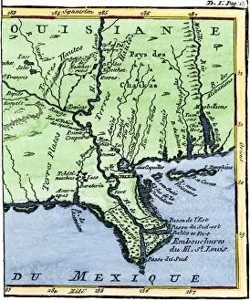
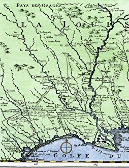
EXPL2A-00302Map of Louisiana, 1744, showing the mouths of the Mississippi River while part of New France. Hand-colored woodcut reproduction of the map
DeSotos route in LouisianaWestern part of De Sotos route, from Desisles map published in 1707. Hand-colored woodcut reproduction of an 18th-century illustration
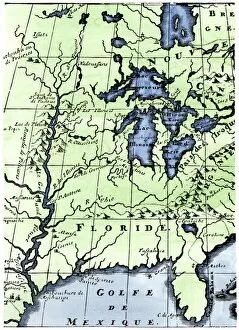
EXPL2A-00218French missionary Louis Hennepins map of the Mississippi River valley, Gulf Coast, and Great Lakes after LaSalle expeditions 1697
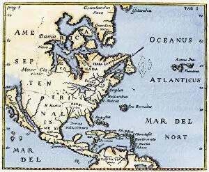
EXPL2A-00375Map of North America as known in the mid-1600s. Hand-colored woodcut reproduction of an illustration in Campanius, 1702
EVCW2A-00110Surrender of the Confederate ironclad " Tennessee, " Battle of Mobile Bay, 1864. Hand-colored woodcut of a 19th century illustration
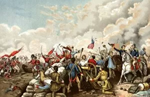
EVNT2A-00021General Andrew Jacksons victory over the British at New Orleans in 1815, at the end of the War of 1812. Printed color lithograph of a 19th century illustration