mail_outline sales@mediastorehouse.com
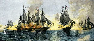
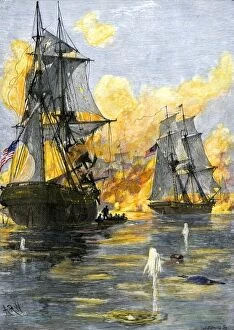
Battle of Lake Erie, War of 1812British and American ships engaged in the Battle of Lake Erie, 1813. Hand-colored woodcut of a 19th-century illustration
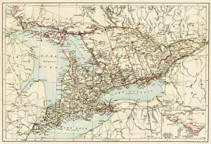
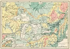
Ontario, 1870sMap of Ontario, Canada, 1870s. Printed color lithograph
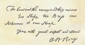
EVNT2A-00196Oliver H. Perrys note proclaiming his Lake Erie victory: " We have met the enemy and they are ours." Woodcut with watercolor wash
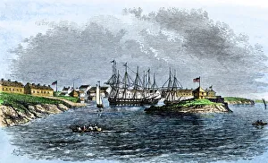
US Navy base at Sackets Harbor, NY, 1814Sackets Harbor on Lake Ontario in 1814, a US Naval station in the War of 1812. Hand-colored woodcut of a 19th century illustration
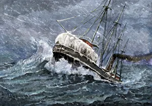
TRAN2A-00040Freighter struggling through a storm on Lake Superior, circa 1900. Hand-colored halftone reproduction of an illustration
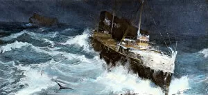
Lake Erie grain boat in a snowstormSteamship carrying grain on Lake Erie in a snowstorm, headed for Buffalo, New York, 1880s. Hand-colored woodcut of a 19th-century illustration
EXPL2A-00128Landing of Jean Nicolet on the Wisconsin shore of Lake Michigan, 1634, the first European to reach that region. Hand-colored halftone of a 19th-century illustration
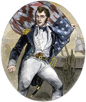
PNAV2A-00002US Navy Commander Oliver Hazard Perry during the Battle of Lake Erie, War of 1812. Hand-colored woodcut of a 19th-century illustratioin
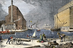
Chicago grain elevators loading ships, 1870sGrain loaded in Chicago on ships bound for the Erie Canal, 1870s. Hand colored woodcut of a 19th-century illustration
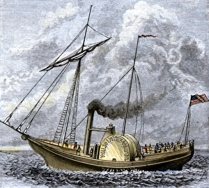
Walk-in-the-Water steamboat on Lake Erie, 1818Lake Erie steamboat " Walk-in-the-Water, " 1818. Hand-colored woodcut of a 19th-century illustration
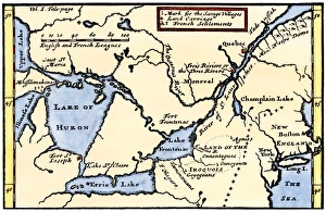
French map of the Great Lakes, 1703La Hontans map of the Great Lakes and Saint Lawrence valley, 1703. Hand-colored 19th-century woodcut reproduction of an 18th century illustration
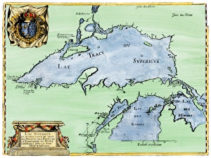
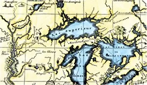
French settlement of the Great Lakes, 1600sFrench Jesuit map of Lake Superior, Upper Michigan, and Wisconsin, 1600s. Hand-colored woodcut of a 17th-century illustration
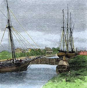
Sault Sainte Marie Canal, US / Canada border, 1880sShips entering Sault Sainte Marie Canal connecting Lakes Superior and Huron on the US/Canada border, 1880s. Hand-colored woodcut of a 19th century illustration
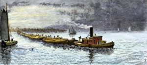
Grain barges leaving Chicago for the Erie CanalBarges loaded with grain from Chicago bound for the Erie Canal, under tow on Lake Michigan, 1870s. Hand-colored woodcut of a 19th-century illustration
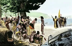
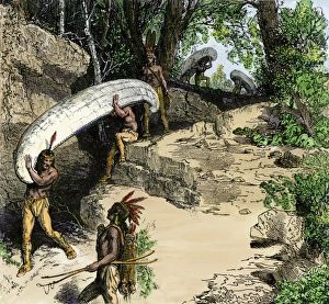
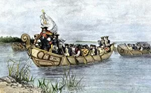
Portaging canoes between waterwaysNative Americans carrying their canoes at a portage. Hand-colored woodcut of a 19th-century illustration
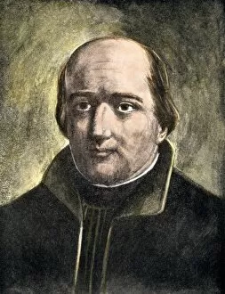
PEXP2A-00066French Jesuit missionary and explorer Jacques Marquette. Hand-colored halftone reproduction of a 19th-century illustration
AGRI2D-00040Wild rice from the Great Lakes area. Digital photograph
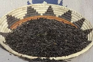
AGRI2D-00039Wild rice from the Great Lakes area, in a basket. Digital photograph
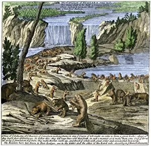
EXPL2A-00356Beavers at work below Niagara Falls, early 1700s. Hand-colored woodcut from Molls New and Exact Map
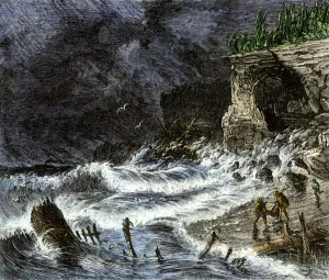
Shipwreck on Lake Superior, 1800sStorm washing shipwreck victims and debris ashore along Lake Superior, 1800s. Hand-colored woodcut of a 19th-century illustration
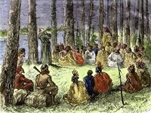
EXPL2A-00175Jesuit missionary preaching to Native Americans and fur traders in the wilderness. Hand-colored woodcut of a 19th-century illustration
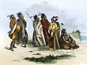
NATI2A-00164Sauk and Fox Native Americans, Algonquian speaking people of the Great Lakes, 1850s. Hand colored woodcut of a 19th-century illustration
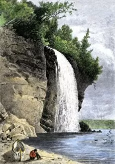
NATI2A-00049Native American and his canoe beside Silver Cascade on the shore of Lake Superior, 1800s. Hand-colored woodcut of a 19th-century illustration
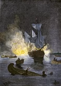
EVNT2A-00267Native Americans burning a schooner in the Detroit River at night during Pontiacs War, 1763-1764. Hand-colored woodcut of a 19th-century illustration
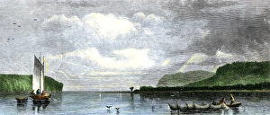
Lake Superior fishing boats, 1800sFishing with nets in Munesing harbor, Lake Superior, 1880s. Hand-colored woodcut of a 19th-century illustration
EVNT2A-00013US fleet of Oliver H Perry during his naval victory over the British on Lake Erie in 1813 during the War of 1812. Hand-colored woodcut of a 19th century illustration
EXPL2A-00357Map of the Great Lakes and the St. Lawrence watershed. Printed color lithograph, 19th century
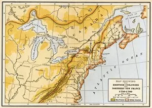
EVNT2A-00019Map showing British colonies and northern New France during the French and Indian War, 1750s. Printed color lithograph of a 19th century illustration
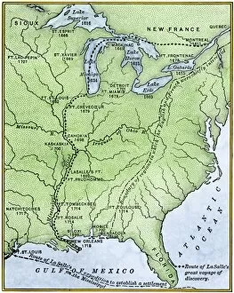
EXPL2A-00171Map showing the route of La Salles explorations in North America, late 1600s. Hand-colored woodcut of a 19th-century illustration
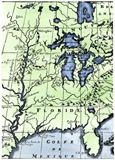
EXPL2A-00218French missionary Louis Hennepins map of the Mississippi River valley, Gulf Coast, and Great Lakes after LaSalle expeditions 1697
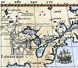
EXPL2A-00329Louis Joliets map of New France, 1673-1674, including the upper Mississippi River he and Jacques Marquette discovered. Hand-colored halftone reproduction
EXPL2A-00350French map of the Great Lakes and upper Mississippi River region, circa 1700. Hand-colored 19th-century woodcut reproduction
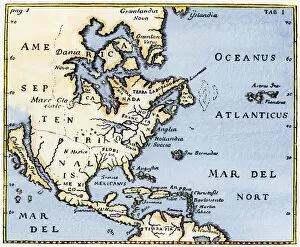
EXPL2A-00375Map of North America as known in the mid-1600s. Hand-colored woodcut reproduction of an illustration in Campanius, 1702
PEXP2A-00026Antoine de La Mothe, Sieur de Cadillac landing on the shore of Lake Saint Clair where he founded Fort Detroit, 1701. Hand colored woodcut of a 19th-century illustration by Howard Pyle
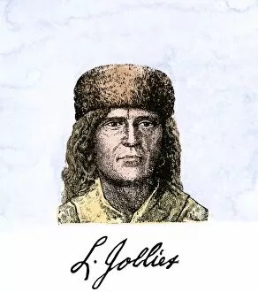
PEXP2A-00055Louis Joliet, with his autograph. Hand-colored 19th-century woodcut of an illustration
EXPL2A-00016Hennepins map of New France and Louisiana - La Carte de la Nouvelle France, 1683. Hand-colored 19th-century woodcut reproduction of the original map
AGRI2D-00041Wild rice from the Great Lakes area. Digital photograph
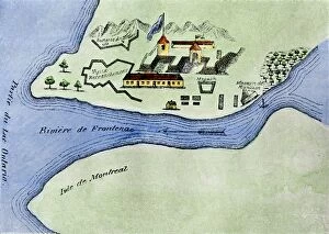
EXPL2A-00267Fort Frontenac on Lake Ontario, 1600s, at the head of the St Lawrence River, now Kingston, Ontario. Hand-colored 19th century halftone reproduction of the original map