mail_outline sales@mediastorehouse.com
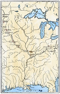
Map of Mandan migrationCaitlins map showing the moves of the Mandans and the place of their extinction, 1837. Hand-colored woodcut of a 19th-century illustration
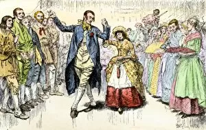
HSET2A-00078A Kentucky wedding, about 1800. Hand-colored woodcut of a 19th-century illustration
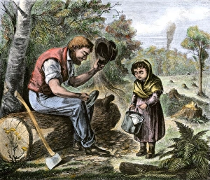
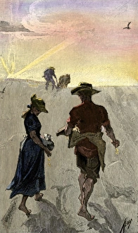
Frontier father getting lunch from his daughterDaughter bringing lunch pail to her father, who is clearing land. Hand-colored woodcut of a 19th-century illustration
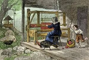
HOUS2A-00101Woman weaving on the porch of her Appalachian cabin, 1800s. Hand-colored woodcut of a 19th-century illustration
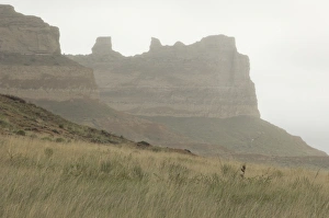
Oregon Trail in western NebraskaOregon Trail, Scotts Bluff National Monument, Nebraska. Digital photograph
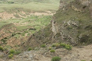
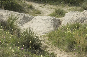
Erosion in western NebraskaErosion in the hills overlooking the Oregon Trail, Scotts Bluff National Monument, Nebraska. Digital photograph
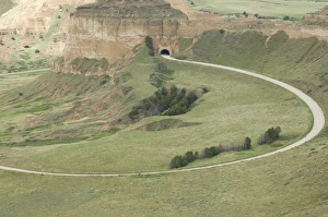
Road ascending Scotts Bluff, NebraskaRoad and tunnel to the top of Scotts Bluff overlooking the Oregon Trail, Scotts Bluff National Monument, Nebraska. Digital photograph
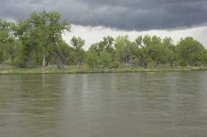
North Platte River in NebraskaStormy sky over the North Platte River along the Oregon and Mormon Trails, Nebraska. Digital photograph
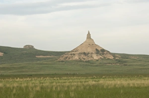
Chimney Rock, NebraskaChimney Rock, a landmark on the Oregon Trail, Nebraska. Digital photograph
Oregon Trail in WyomingWagon ruts of the Oregon Trail near Guernsey, Wyoming. Digital photograph
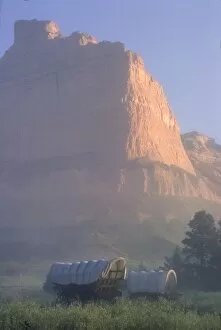
HSET2P-00104Covered wagons on the Oregon Trail at sunrise, Scotts Bluff, Nebraska. Photograph
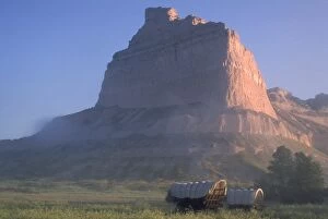
HSET2P-00108Covered wagons on the Oregon Trail at sunrise, Scotts Bluff, Nebraska. Photograph
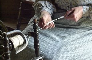
Norwegian immigrant homestead, Old World WisconsinNorwegian immigrant farm woman reenactor spinning wool in the Kvaale House, built circa 1848, at Old World Wisconsin, Eagle WI. Digital photograph
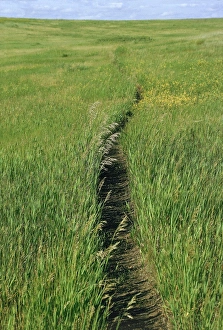
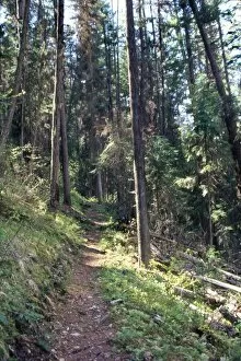
Trail in the grasslands of North DakotaPrairie footpath on Lewis and Clarks route near Mandan, North Dakota. Photograph
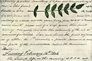
EXPL2A-00168William Clarks sketch of an evergreen shrub leaf in the Lewis and Clark expedition diary, 1806. Hand-colored halftone reproduction of a 19th-century photograph of Clarks handwritten page
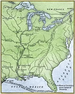
EXPL2A-00171Map showing the route of La Salles explorations in North America, late 1600s. Hand-colored woodcut of a 19th-century illustration
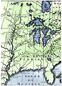
EXPL2A-00218French missionary Louis Hennepins map of the Mississippi River valley, Gulf Coast, and Great Lakes after LaSalle expeditions 1697
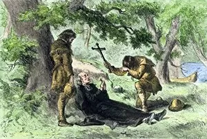
EXPL2A-00257Death of Father Marquette in Michigan, returning from a mission to the Ilinois Indians, 1675. Hand-colored woodcut of a 19th-century illustration
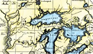
EXPL2A-00350French map of the Great Lakes and upper Mississippi River region, circa 1700. Hand-colored 19th-century woodcut reproduction
EXPL2D-00028Missouri River where Lewis and Clark had their first meeting with the Sioux Nation, near Pierre, South Dakota, 1804. Digital photograph
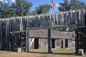
EXPL2P-00037Fort Mandan, reconstructed Lewis and Clark campsite on Missouri River, North Dakota. Photograph
EXPL2P-00061Lewis and Clark trail over Lolo Pass, Bitterroot Mountains, Montana. Photograph
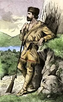
PEXP2A-00004Daniel Boone in the Kentucky wilderness. Hand-colored woodcut of a 19th-century illustration
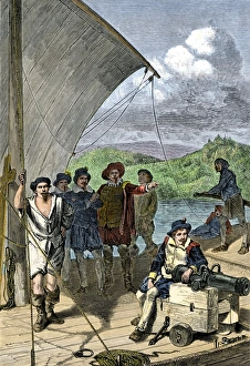
Early exploration of the Maine coastEnglish explorers sailing up the Penobscot River on the coast of Maine. Hand-colored woodcut of a 19th-century illustration
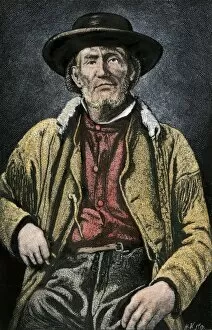
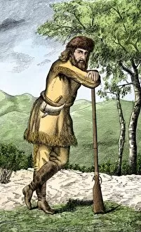
PEXP2A-00100Jim Bridger. Hand-colored woodcut reproduction of a photograph
PEXP2A-00099Christopher Gist exploring the wilderness of Ohio, western Pennsylvania, and Kentucky. Hand-colored woodcut of a 19th-century illustration
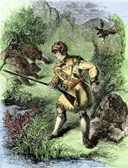
PEXP2A-00087Davy Crockett facing grizzly bears. Hand-colored woodcut of a 19th-century illustration
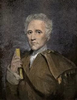
PEXP2A-00084Daniel Boone holding a book Hand-colored engraving from a painting by Sully
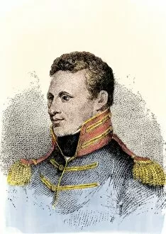
PEXP2A-00046Zebulon Montgomery Pike, explorer of the American West. Hand-colored woodcut of a 19th-century illustration
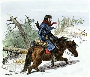
PEXP2A-00045John Finley, discoverer of Kentucky. Hand-colored woodcut of a 19th-century illustration
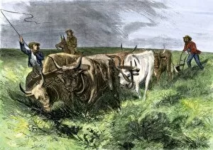
HSET2A-00119Pioneers and their ox-teams plowing the prairies west of the Mississippi, 1800s. Hand-colored woodcut of a 19th-century illustration
Homesteaders planting corn on the prairieHomesteaders dropping seeds to sow corn on the Great Plains, 1800s. Hand-colored woodcut of a 19th-century illustration
HSET2A-00085Pioneer children bringing the cows home, southern Appalachians. Hand-colored woodcut of a 19th-century illustration
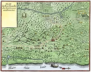
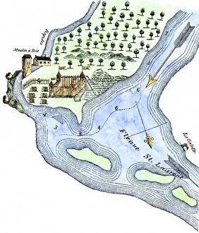
EXPL2A-00124Fort Rozalie des Natchez on the Mississippi River 1700s - North is to the right. Hand-colored woodcut of a map published in 1770. Fleuve Saint Louis was the French name for the Mississippi River
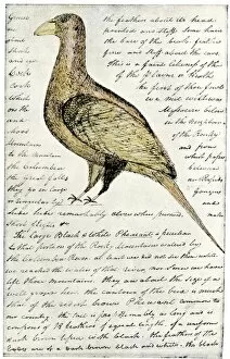
EXPL2A-00117Sketch by William Clark of Cock of the Plains in the Lewis and Clark expedition diary. Hand-colored halftone of a 19th-century reproduction of the diary
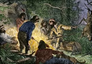
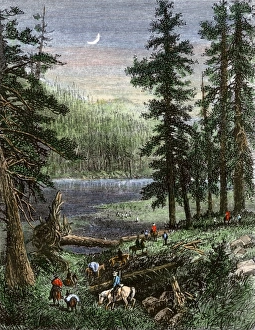
BUSN2A-00005Trappers and woodsmen exchanging stories around a campfire. Hand-colored woodcut of a 19th-century illustration
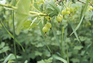
Gooseberries in a homestead garden, WisconsinGooseberries in a Scandinavian immigrant garden, Old World Wisconsin, Eagle, Wisconsin. Photograph
Wheelers expedition in the southern Rockies, 1870sGeorge M. Wheelers expedition exploring the Sangre de Cristo range in Colorado and New Mexico, 1870s. Hand-colored woodcut of a 19th-century illustration
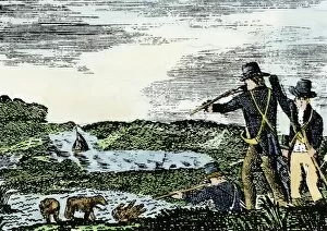
EXPL2A-00092Lewis and Clark shoot a grizzly bear, unknown to whites, during their exploration of Louisiana Territory. Hand-colored woodcut reproduction of sketch by Patrick Goss
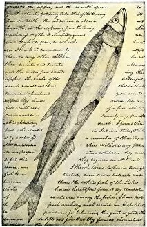
EXPL2A-00166William Clarks sketch of a trout in the Lewis and Clark expedition diary. Hand-colored halftone reproduction of a 19th-century photograph of Clarks handwritten page
EXPL2A-00183Samuel de Champlains fortified camp at Quebec on the St Lawrence River, 1600s Hand-colored 19th-century woodcut of a 17th-century map
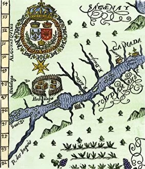
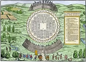
EXPL2A-00246Hochelaga, site of Montreal, shown as a Native American village in Lescarbots map, 1609. Hand-colored 19th-century woodcut reproduction of a 17th-century document
EXPL2A-00249French colonists building fort at Hochelaga, a native village and the site of Montreal, Canada, 1600s. Hand-colored halftone reproduction of a 17th-century illustration
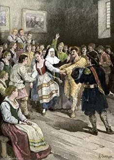
GCAN2A-00012French-Canadians enjoying a dance in early Quebec. Hand-colored woodcut of a 19th-century illustration
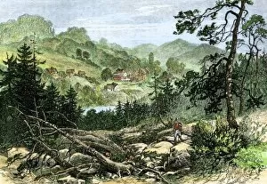
GCAN2A-00007Pioneer settlement on the frontier in Canada, 1800s. Hand-colored woodcut of a 19th-century illustration
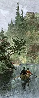
BUSN2A-00204French traders canoeing on a river in the forests of North America. Hand-colored woodcut of a 19th century illustration
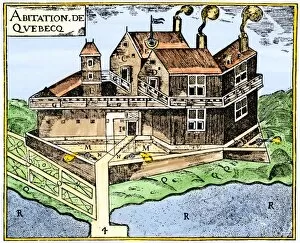
EXPL2A-00295Champlains Quebec fort, 1613, showing the dwellings (C, D), drawbridge (I), Moat (M), cannon (N), garden (O). Hand-colored 19th-century woodcut reproduction of Champlains drawing
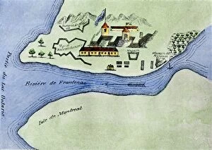
EXPL2A-00267Fort Frontenac on Lake Ontario, 1600s, at the head of the St Lawrence River, now Kingston, Ontario. Hand-colored 19th century halftone reproduction of the original map