mail_outline sales@mediastorehouse.com
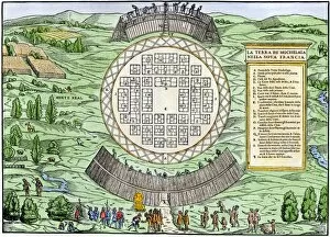
EXPL2A-00249French colonists building fort at Hochelaga, a native village and the site of Montreal, Canada, 1600s. Hand-colored halftone reproduction of a 17th-century illustration
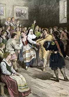
GCAN2A-00012French-Canadians enjoying a dance in early Quebec. Hand-colored woodcut of a 19th-century illustration
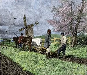
GCAN2A-00008French-Canadian farmers plowing in the Saint Lawrence valley of Quebec, 1800s. Hand colored woodcut of a 19th-century illustration
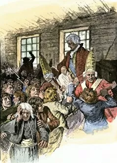
GCAN2A-00006Catholic clergyman of the Order of St. Sulpice, Quebec, Canada, circa 1700. Hand-colored woodcut of a 19th-century illustration
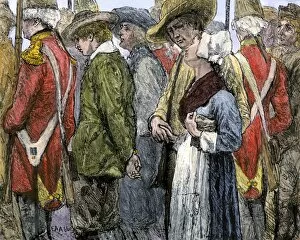
GCAN2A-00003British official reading the Decree of Expulsion to Acadians in Canada, 1755. Hand-colored woodcut of a 19th-century illustration
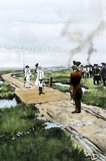
GCAN2A-00002British removing Acadians from Canada in 1755. Hand-colored woodcut of a 19th-century illustration
EXPL2A-00087Jacques Cartier on the summit of Mont Real, now Montreal, Canada, 1535. Hand-colored woodcut of a 19th-century illustration
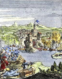
EXPL2A-00080Capture of French Quebec by the English, 1629. Hand-colored woodcut reproduction from Hennepin 1698
EXPL2A-00058Samuel de Champlains map of the Gaspee and Gulf of the Saint Lawrence River, 1632. Hand-colored woodcut reproduction of the original map
Surrender of Louisbourg to the English, 1758French surrender of Louisbourg, Canada, French and Indian War, 1758. Hand-colored halftone reproduction of a 19th-century Howard Pyle illustration
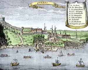
EXPL2A-00025Quebec City and the Saint Lawrence River, 1722. Hand-colored 18th-century woodcut from La Potherie
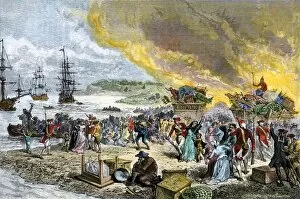
GCAN2A-00001Deportation of the Acadians by the British, 1755. Hand-colored woodcut of a 19th-century illustration
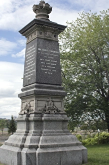
Cartier monument on the St Lawrence, QuebecMonument marking Jacques Cartiers landing place on the St Lawrence River in Quebec. Digital photograph
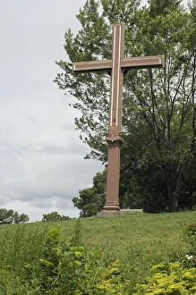
Cartiers landing place on the St Lawrence, QuebecReplica cross marking Jacques Cartiers landing place on the St Lawrence River in Quebec. Digital photograph
BUSN2A-00204French traders canoeing on a river in the forests of North America. Hand-colored woodcut of a 19th century illustration
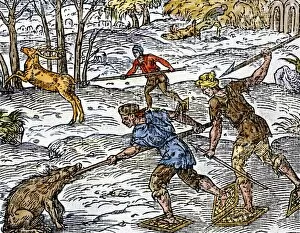
BUSN2A-00152Early settlers hunting on snowshoes in Canada. Hand-colored woodcut
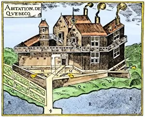
EXPL2A-00295Champlains Quebec fort, 1613, showing the dwellings (C, D), drawbridge (I), Moat (M), cannon (N), garden (O). Hand-colored 19th-century woodcut reproduction of Champlains drawing
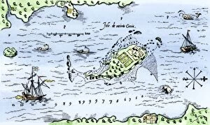
EXPL2A-00296Map of Champlains settlement on the Isle de Sainte Croix, Canada, 1613. Hand-colored 19th-century woodcut reproduction of the original map
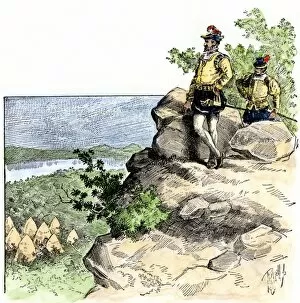
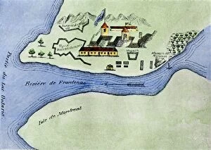
EXPL2A-00267Fort Frontenac on Lake Ontario, 1600s, at the head of the St Lawrence River, now Kingston, Ontario. Hand-colored 19th century halftone reproduction of the original map
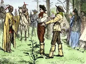
BUSN2A-00096Fur traders and Native Americans conversing in pantomine. Hand-colored woodcut of a 19th-century illustration
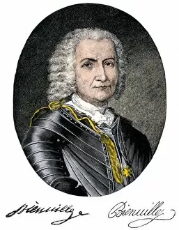
PEXP2A-00031Jean-Baptiste Le Moyne, Sieur de Bienville, portrait with autograph. Hand-colored 19th-century engraving
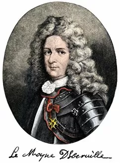
PEXP2A-00030Pierre Le Moyne, Sieur d Iberville, portrait with autograph. Hand-colored 19th-century engraving
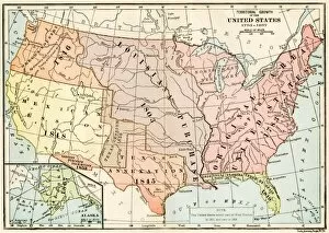
EXPL2A-00041Map of territorial growth of the United States from 1783-1867. Printed color lithograph of a 19th-century illustration
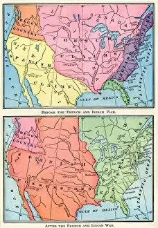
EXPL2A-00151Maps of North American colonies before and after the French and Indian War, 1700s. Printed color lithograph of a 19th century illustration