mail_outline sales@mediastorehouse.com
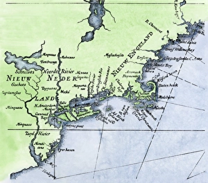
Dutch map of New Netherland and New EnglandNew Netherland and New England, circa 1630. Hand-colored 19th-century woodcut reproduction of DeLaets map
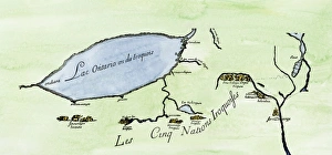
Iroquois Nations map, 1600sFrench map of the Five Iroquois Nations homeland and Fort Orange (Albany), 1660s. Hand-colored woodcut of a 17th-century illustration
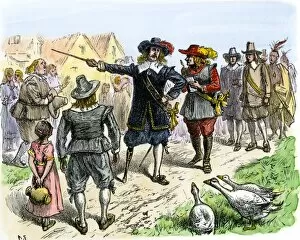
PUSA2A-00071Peter Stuyvesant at Fort Orange ( now Albany), New Netherland, 1648. Hand-colored woodcut of a 19th-century illustration