mail_outline sales@mediastorehouse.com
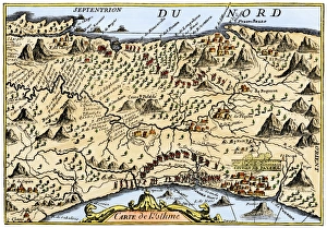
Isthmus of Panama, 1744Map from Oexmelins Histoire of the Isthmus of Panama, 1744. Hand-colored woodcut
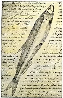
EXPL2A-00166William Clarks sketch of a trout in the Lewis and Clark expedition diary. Hand-colored halftone reproduction of a 19th-century photograph of Clarks handwritten page
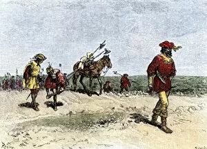
EXPL2A-00163Alvar Nunez Cabeza de Vaca crossing the Great American Desert from Texas to Mexico, early 1500s. Hand-colored woodcut of a 19th-century illustration
EXPL2A-00150Chart of Vitus Berings voyage from Kamchatka, Russia, to North America, 1700s. Hand-colored 19th-century woodcut reproduction
EXPL2A-00143La Salle landing in Matagorda Bay Texas to colonize Louisiana Terrritory and the Mississippi valley area, 1685. Hand-colored 19th-century woodcut reproduction of an earlier illustration
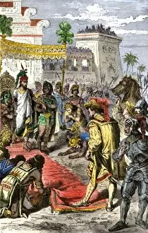
EXPL2A-00132Meeting of Hernando Cortes and Aztec emperor Montezuma II in Tenochtitlan, 1519. Hand-colored woodcut of a 19th-century illustration
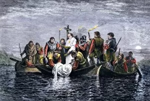
EXPL2A-00129Secret burial of Hernando de Soto at night in the Mississippi River, 1542. Hand-colored woodcut of a 19th-century illustration
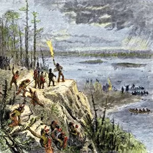
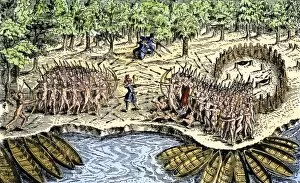
EXPL2A-00109Samuel de Champlain and his Huron allies going to fight the Iroquois, Lake Champlain, 1600s. Hand-colored woodcut of a 19th-century illustration
EXPL2A-00110Samuel de Champlains defeat of the Iroquois at Lake Champlain, opening the settlement of New France, 1600s. Hand-colored woodcut
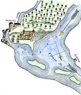
EXPL2A-00183Samuel de Champlains fortified camp at Quebec on the St Lawrence River, 1600s Hand-colored 19th-century woodcut of a 17th-century map
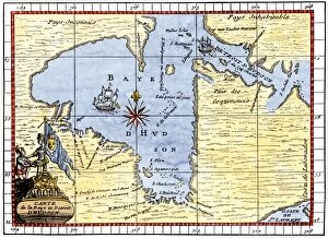
EXPL2A-00190Map of Hudsons Bay, Canada, showing Hudsons Strait, 1722. Hand-colored 19th-century woodcut reproduction of an 18th-century map
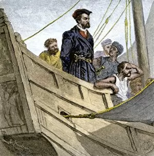
EXPL2A-00232Jacques Cartier aboard ship arriving on the shore of Canada, 1534. Hand-colored woodcut of a 19th-century illustration
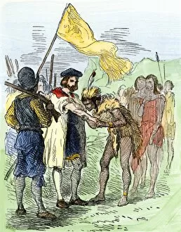
EXPL2A-00247Jacques Cartier embraced by Donnacona, a native Canadian Huron chief, Gaspee Peninsula, 1535. Hand-colored woodcut of a 19th-century illustration
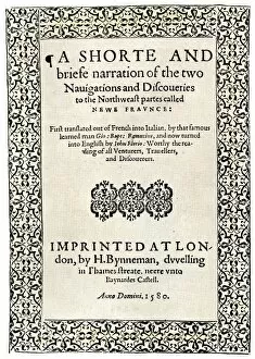
EXPL2A-00251Title page of the London edition of Jacques Cartiers book about his discoveries in Canada, printed in 1580. Watercolor wash over a 19th-century printed halftone reproduction
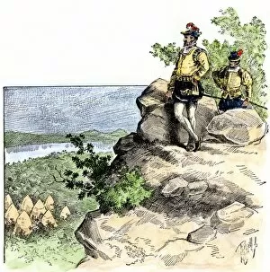
EXPL2A-00087Jacques Cartier on the summit of Mont Real, now Montreal, Canada, 1535. Hand-colored woodcut of a 19th-century illustration
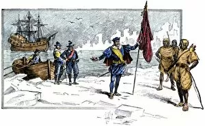
EXPL2A-00085English Explorer John Cabot landing on the shore of Canada, 1484. Hand-colored woodcut of a 19th-century illustration
EXPL2A-00058Samuel de Champlains map of the Gaspee and Gulf of the Saint Lawrence River, 1632. Hand-colored woodcut reproduction of the original map
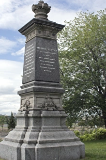
Cartier monument on the St Lawrence, QuebecMonument marking Jacques Cartiers landing place on the St Lawrence River in Quebec. Digital photograph
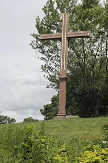
Cartiers landing place on the St Lawrence, QuebecReplica cross marking Jacques Cartiers landing place on the St Lawrence River in Quebec. Digital photograph
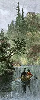
BUSN2A-00204French traders canoeing on a river in the forests of North America. Hand-colored woodcut of a 19th century illustration
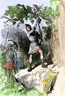
EXPL2A-00306Discovery of grapes by Leif Erikssons expedition, 1001 AD, leading to naming the new land Vinland. Hand-colored woodcut of a 19th-century illustration
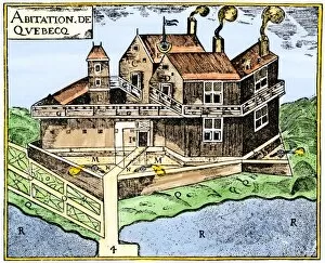
EXPL2A-00295Champlains Quebec fort, 1613, showing the dwellings (C, D), drawbridge (I), Moat (M), cannon (N), garden (O). Hand-colored 19th-century woodcut reproduction of Champlains drawing
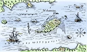
EXPL2A-00296Map of Champlains settlement on the Isle de Sainte Croix, Canada, 1613. Hand-colored 19th-century woodcut reproduction of the original map
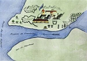
EXPL2A-00267Fort Frontenac on Lake Ontario, 1600s, at the head of the St Lawrence River, now Kingston, Ontario. Hand-colored 19th century halftone reproduction of the original map
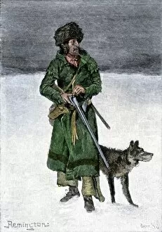
BUSN2A-00020French-Canadian trapper in the snow. Hand-colored 19th-century woodcut of a Frederic Remington illustration
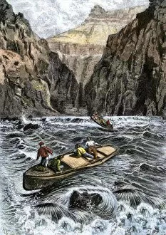
EXPL2A-00144John Wesley Powells Grand Canyon expedition running rapids on the Colorado River, 1870s. Hand colored woodcut from Powells published account 1870s
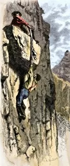
EXPL2A-00145Rescue of John Wesley Powells Colorado River expedition by climbing out of the Grand Canyon, 1870s. Hand colored woodcut from Powells published account, 1870s
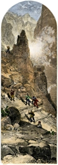
Powells expedition surveying the Grand Canyon, 1870sJohn Wesley Powells Colorado River expedition climbing out of the Grand Canyon, Arizona, circa 1870. Hand-colored woodcut of a 19th-century illustration
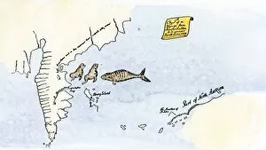
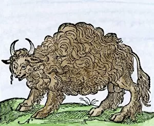
EXPL2A-00244Possibly the earliest engraving of an American buffalo, 1558 - first mentioned by Cabeza de Vaca. Hand-colored 19th-century woodcut reproduction of the original 16th-century engraving
EXPL2A-00300Fire destroying the camp of John Wesley Powell during his exploration of the Grand Canyon 1870s. Hand colored woodcut of an illustration from publication of the Powell expedition report
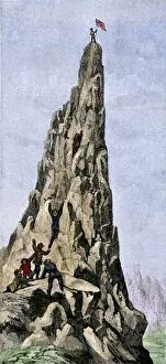
EXPL2A-00348Fremont expedition raising the American flag on the Rockies, 1842. Hand-colored woodcut of a 19th-century illustration
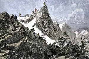
EXPL2A-00349John C. Freemont planting the US flag on the Colorado Rockies, 1842. Hand-colored woodcut of a 19th-century illustration
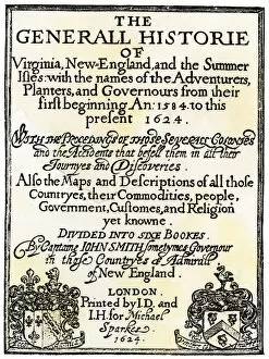
EXPL2A-00290Title page of John Smiths " General Historie of Virginia, New England, and the Summer Isles..." printed in 1624. Woodcut with a watercolor wash
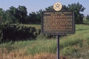
Jedediah Smith route marker in the Black HillsJedediah Smiths route in 1823 through Buffalo Gap in the Black Hills, South Dakota. Photograph
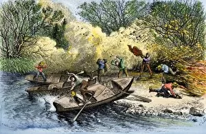
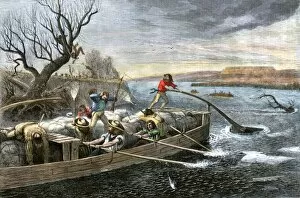
BUSN2A-00062Fur-traders on the Missouri River attacked by Native Americans. Hand-colored woodcut of a 19th-century illustration
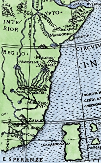
Cape of Good Hope mapped at its correct latitude, 1508First map showing Africas southern point at the correct latitude, from Ruysch 1508. Hand-colored woodcut reproduction of a 16th-century illustration
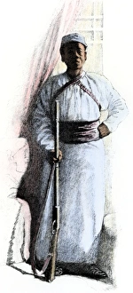
Stanleys African servant, 1880sSali, African servant of explorer Henry Stanley throughout the 1887-1889 expedition and in Cairo. Hand-colored halftone reproduction of a 19th-century illustration