mail_outline sales@mediastorehouse.com
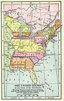
EXPL2A-00164Map of the United States at the close of the American Revolution, 1783. Printed color lithograph of a 19th-century illustration
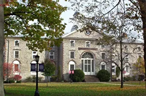
Dickinson College, Carlisle, PennsylvaniaOldest Dickinson College building, " Old West" Hall, designed by Benjamin Latrobe, built in 1803 to replace the original college hall, which burned. Digital photograph
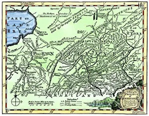
Colonial Pennsylvania map, 1750sMap of the " Province of Pennsilvania, " 1756. Hand-colored 19th-century woodcut reproduction of an 18th-century illustration
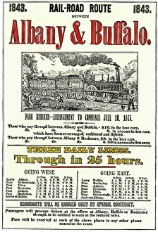
Albany & Buffalo Railroad schedule, 1843Albany & Buffalo Railroad timetable, showing fares and routes, 1843. Hand-colored woodcut of a 19th-century printed piece
Thomas Jeffersons Rotunda at the University of VirginiaRotunda of the University of Virginia, designed by Thomas Jefferson, Charlottesville. Digital photograph
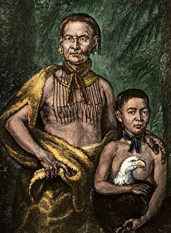
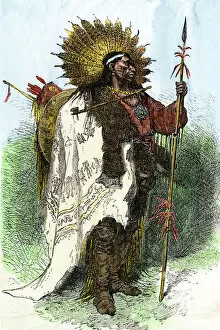
Tomochichi and his sonYamacraw chief Tomo-chichi Mico and his son. Hand-colored woodcut of an illustration
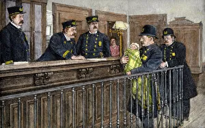
Abandoned baby found by police, New York City, 1890sPoliceman bringing in an abandoned infant found in an alley on a winter night, New York City, 1890s. Hand-colored woodcut reproduction of a 19th-century photograph
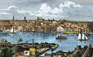
Baltimore in the 1870sHarbor of Baltimore, Maryland, looking from Federal Hill, 1870s. Hand-colored woodcut of a 19th-century illustration
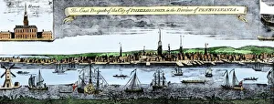
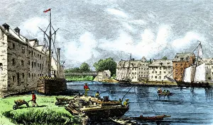
Delaware River waterfront of Philadelphia, 1750sColonial Philadelphias skyline and harbor, 1750s. Hand-colored woodcut of an 18th-century illustration
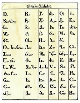
NATI2A-00094Cherokee alphabet developed by Sequoyah. Woodcut reproduction with a watercolor wash
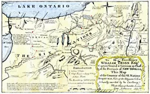
NATI2A-00044Map of the Six Iroquois Nations in Pennsylvania and New York, 1771. Hand-colored woodcut reproduction of an 18th-century document
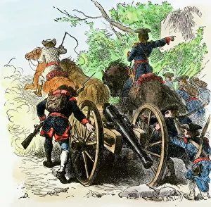
Moving artillery in the French and Indian WarColonial artillery passing over Appalachian Mountains, French and Indian War. Hand-colored woodcut of a 19th-century Darley illustration
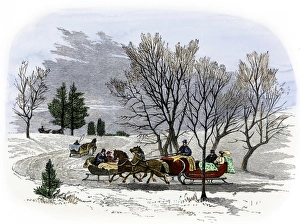
Sleighs in the 19th centurySleigh travel on a road in winter, 1800s. Hand-colored woodcut of a 19th-century illustration
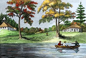
Swedish colonists on the Delaware RiverSwedes Church and house of Sven Sener on the Delaware River, colonial Pennsylvania. Hand-colored woodcut of a 19th-century illustration
NATI2A-00113Wampanoag warrior in full costume, Massachusetts. Hand-colored woodcut of a 19th-century illustration
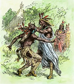
Tecumseh and his brother, The ProphetTecumseh pulling his brother, The Prophet, by the hair. Hand-colored woodcut reproduction of a 19th-century illustration
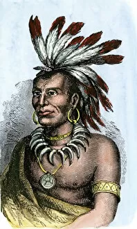
PNAT2A-00020Little Turtle, chief of Miami tribe. Hand-colored woodcut of a portrait
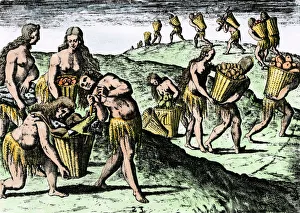
Natives gathering food in Florida, 1500sFlorida Native Americans gathering crocodiles, fish, and other wild animals and plants, 1591. Hand-colored Debry engraving of a LeMoyne painting
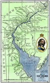
EXPL2A-00165Map of colonial New Sweden in America, 1638-1685. Hand-colored 19th-century woodcut reproduction of a 17th-century map
Brandywine Creek industry, Delaware, 1800sOld mills along Brandywine Creek, Delaware, 1800s. Hand-colored woodcut of a 19th-century illustration
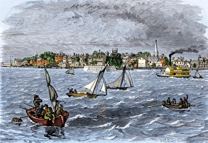
Boats on the Delaware River near New Castle, 1880sCity of New Castle on the Delaware River, 1880s. Hand-colored woodcut of a 19th-century illustration
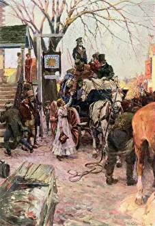
Stagecoach stop in a town along the post roadVillage stagecoach stop to change horses, early 1800s. Color halftone reproduction of an S.M. Arthurs illustration
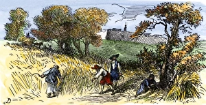
Colonial farmers in New Sweden, 1600sSwedish settlers harvesting wheat in Delaware, 1600s. Hand-colored woodcut of a 19th-century illustration
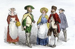
Colonists of New SwedenClothing of Swedish settlers in colonial Delaware, 1600s. Hand-colored woodcut of a 19th-century illustration
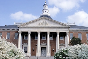
Maryland state capitol, AnnapolisMaryland statehouse in Annapolis, at one time the U.S. capitol. Photograph
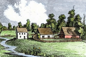
Colonial farm in Germantown, PennsylvaniaShoemakers farm in Germantown, Pennsylvania, early 1700s. Hand-colored woodcut of a 19th-century illustration
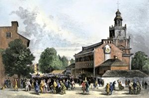
Philadelphias Old State House, 1700sOld State House, later called Independence Hall, Philadelphia, 1700s. Hand-colored engraving
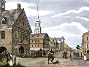
Downtown Philadelphia, about 1800Philadelphia, looking up Second Street from Market Street, circa 1800. Hand-colored woodcut of an illustration
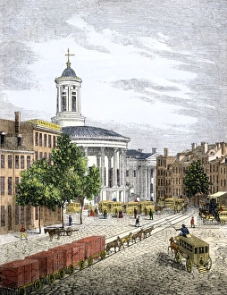
Center of Philadelphia, 1850sThe Exchange, omnibus depot, and part of Dock Street, Philadelphia, 1850s. Hand-colored woodcut of a 19th-century illustration
Colonial shipyardShip-building in colonial North America. Hand-colored woodcut of a 19th-century illustration
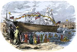
Clipper ship Flying Cloud launched in BostonLaunch of shipbuilder Donald McKays clipper ship " Flying Cloud" in Boston, 1851. Hand-colored woodcut of a 19th-century illustration
Ship-building in New England, 1800sBusy New England shipyard in the 19th century. Hand-colored woodcut of a 19th-century illustration
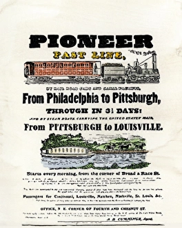
Travel by railroad and canal, 1837Advertisement for rail and canal travel from Philadelphia to Pittsburgh and Louisville, 1837. Hand-colored woodcut of a 19th-century illustration
Lenape wampum in honor of Penns treatyWampum received by William Penn in commemeration of his treaty with Native Americans in Pennsylvania. Hand-colored 19th-century woodcut reproduction of the artifact
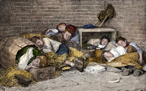
Homeless boys sleeping in an alley, 1890sHomeless street boys sleeping in an alley in New York City, 1890s. Hand-colored woodcut reproduction of a 19th-century photograph
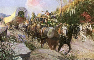
National Road wagons and stagecoach trafficMail coach and slower wagons on the National Road, early 1800s. Printed color halftone reproduction of an Arthurs illustration
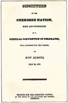
NATI2A-00161Title page, Constitution of the Cherokee Nation, 1827, New Echota, Georgia. Hand-colored woodcut reproduction of the document
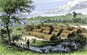
NATI2A-00163Native American longhouses on Manhattan Island before the arrival of Dutch settlers. Hand-colored woodcut of a 19th-century illustration
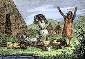
NATI2A-00047Great mortality amoung the Wampanoags due to smallpox, colonial Massachusetts, 1600s. Hand-colored woodcut
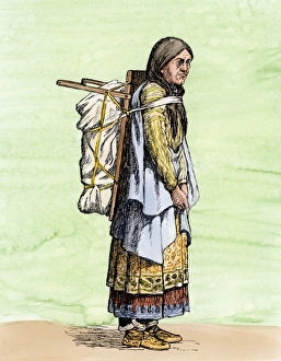
Iroquois woman, late 1800sIroquois woman packing goods on her back, 1890s. Hand-colored woodcut of a 19th-century illustration
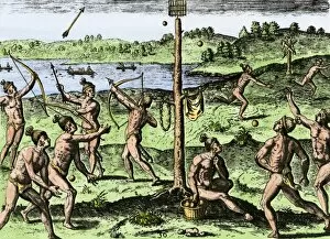
NATI2A-00031Native Americans practice running, shooting arrows, and throwing ball, Florida, 1500s. Hand-colored woodcut reproduction of a DeBrfy engraving of a LeMoyne illustration
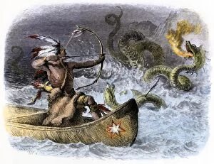
PNAT2A-00017Hiawatha aiming his arrow at a sea-dragon. Hand-colored woodcut of a 19th-century illustration
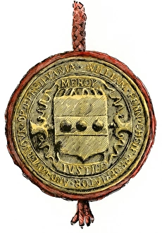
Pennsylvania colonys sealSeal of William Penns colony of " Pennsilvania." Hand-colored 19th-century woodcut reproduction of the artifact
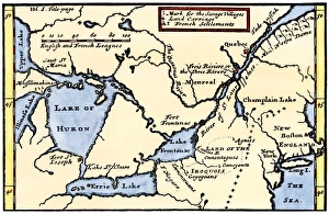
French map of the Great Lakes, 1703La Hontans map of the Great Lakes and Saint Lawrence valley, 1703. Hand-colored 19th-century woodcut reproduction of an 18th century illustration
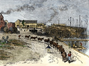
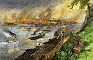
Pittsburgh from the Ohio River, 1880sSteel mills darken the sky over Pittsburgh, Pennsylvania, 1880s. Hand-colored woodcut of a 19th-century illustration
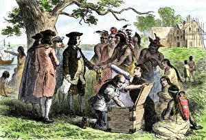
Native Americans friendship with William PennWilliam Pennss treaty with Native Americans in Pennsylvania, 1680s. Hand-colored woodcut of a 19th-century illustration
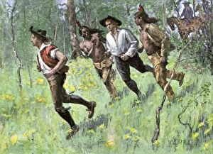
Walking Purchase land claim in colonial PennsylvaniaWilliam Penns Walking Purchase agreement with Native Americans for as much land as a man could walk in 3 days. Hand-colored halftone reproduction of a 19th-century illustration
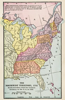
Northwest Territory mapMap of the old Northwest Territory, 1787. Printed color lithograph of a 19th-century illustration