mail_outline sales@mediastorehouse.com
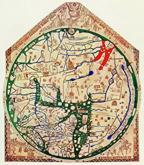
EXPL2A-00352The Hereford Mappa Mundi of 1280 - Jerusalem is at the center, Europe lower left, Africa lower right. Printed color halftone reproduction 19th century
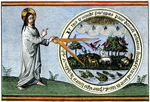
Creation of the heaven and earthGod creating the world by compass. Hand-colored woodcut reproduction of a manuscript of the 1400s
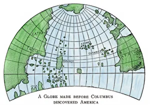
Globe of 1492, lacking the New WorldDiagram of Martin Behaims globe, made just before Columbus discovered America. Hand-colored woodcut of a 19th-century illustration
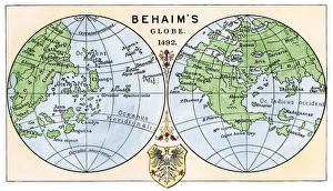
Behaims 1492 globe showing a round Earth but no New WorldDiagram of globe by Martin Behaim, without the New World, created in 1492. Hand-colored woodcut of a 19th-century illustration
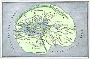
EXPL2A-00138Map of the flat earth according to Herodotus, ancient Greek historian. Hand-colored woodcut of a 19th-century illustration
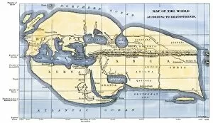
EXPL2A-00317Map of the world according to ancient Greek geographer Eratosthenes. Hand-colored 19th-century woodcut reproduction
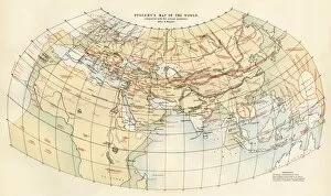
EXPL2A-00353Ptolemys map of the world shown in red, true locations in black. Printed color lithograph 19th century
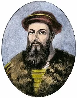
PEXP2A-00035Portuguese explorer Ferdinand Magellan. Hand-colored halftone reproduction of a 19th-century illustration
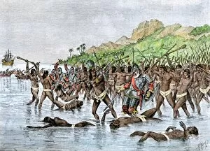
EXPL2A-00088Death of Magellan on the island of Mactan, Philippines, in 1521, before completing his circumnavigation of the earth. Hand-colored woodcut of a 19th-century illustration
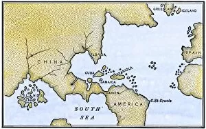
EXPL2A-00147World map after the disoveries of Columbus and Balboa, showing the prevalent idea that South America was attached to Asia. Hand-colored woodcut of a 19th-century illustration
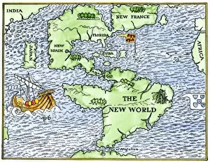
EXPL2A-00148New World geography according to a mapmaker of 1540. Hand-colored woodcut of a 19th-century illustration