mail_outline sales@mediastorehouse.com
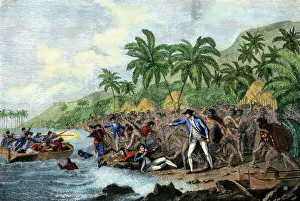
Captain Cook killed by Hawaiian natives, 1779Death of English explorer Captain James Cook in the Sandwich Islands (Hawaii), 1779. Hand-colored woodcut reproduction of a painting
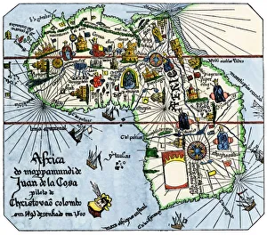
Vasco da Gamas route around Africa, 1400sAfrica as known after Vasco da Gamas discoveries, from map of Juan de la Cosa, 1500. Hand-colored woodcut reproduction
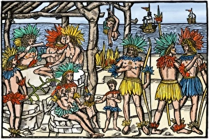
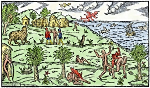
Brazilian cannibalism, 1500sNatives eating and cooking human flesh, northern Brazil, circa 1500. Hand-colored woodcut reproduction of a 16th-century illustration
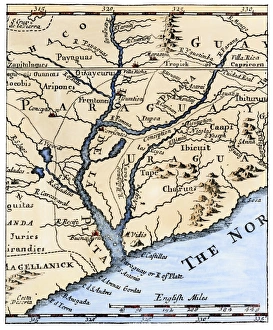
Rio de la Plata, 1698Mouth of the Rio de la Plata in South America, in a map of 1698. Hand-colored woodcut of a 19th-century illustration
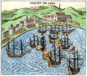
Callao, Peru, under Spanish rule, 1620Spanish colonial port of Callao, Peru, circa 1620. Hand-colored woodcut reproduction of a 17th-century illustration
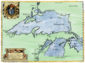
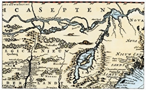
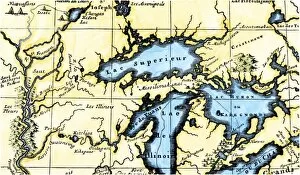
French settlement of the Great Lakes, 1600sFrench Jesuit map of Lake Superior, Upper Michigan, and Wisconsin, 1600s. Hand-colored woodcut of a 17th-century illustration
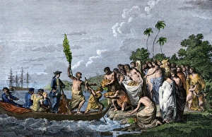
Captain Cook landing on a South Pacific island, 1770sJames Cook landing in the Friendly Islands, greeted by Tonga natives bearing fruit, 1770s. Hand-colored engraving of a 19th-century illustration
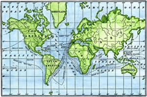
Great voyages of the age of explorationMap of great voyages from 1492 to 1580. Hand-colored woodcut of a 19th-century illustration
Sir Richard Burton exploring central Africa, 1850sEnglish explorer Richard Burtons march towards central Africa, 1850s. Hand-colored woodcut of a 19th-century illustration
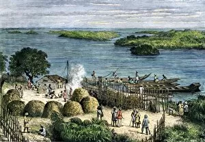
EXPL2A-00359African explorer Henry Stanleys camp on the Congo River, 1870s. Hand-colored woodcut of a 19th century illustration
Dr. Livingstone, I presume? 1871Stanley finding Dr. Livingstone at Ujiji, Tanganyika, 1871. Hand-colored woodcut of a 19th-century illustration
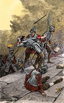
Pizarro capturing Inca stronghold in Peru, 1533Pizarros assault on the Inca fortress of Sacsahuaman, Peru, 1533. Hand-colored woodcut of a 19th-century illustration
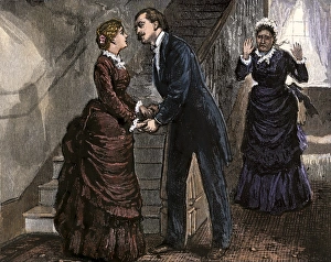
Romantic moment discovered, 1800sMan leaning to kiss a young woman, surprising an older woman, 1870s. Hand-colored woodcut of a 19th-century illustration
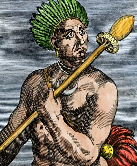
Patagonian as described by early explorers, 1500sQuoniambec, a Patagonia native described as a giant by explorers. Hand-colored woodcut reproduction of a 16th-century illustration
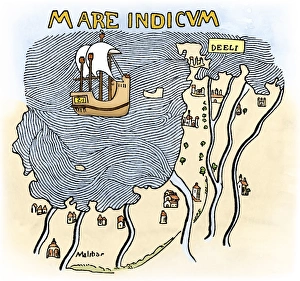
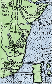
Portuguese traders in India and Ceylon, 1500Calcutta and the southern coast of India, from Juan de la Cosas map, 1500. Hand-colored woodcut reproduction of a 16th-century illustration
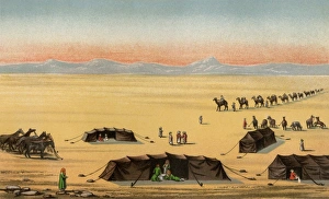
Sir Richard Burtons journey to Mecca, 1850sExplorer Richard Burtons desert camp in Arabia during his journey to Mecca, 1850s. Color lithograph
Early depiction of Brazil in the Age of DiscoveryBrazil coast, natives, and New World flora and fauna as known in 1586. Hand-colored woodcut from De Lery
Dutch map of eastern North America, 1670Nova Belgh Tabula, map of New Netherland and New England, 1670. Hand-colored woodcut reproduction
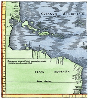
Early map of the New World, 1513Tabula Terre Nove 1513: the Admirals Map of the Caribbean and Terra Incognita (unknown lands). Hand-colored woodcut reproduction
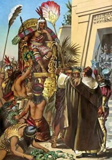
EXPL2A-00030Missionary Father Valverde addresses the Inca king Atahualpa during the Spanish conquest of Peru, 1532. Printed color lithograph of a 19th-century illustration
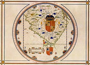
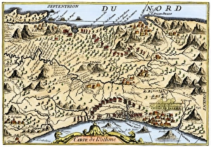
Portuguese map of the tip of South America, 1571Map of South America printed in Lisbon, 1571. Printed color halftone reproduction
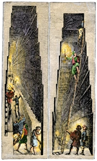
Visitors inside the Pyramid of Gizeh, early 1800sEuropean visitors exploring chambers inside the Great Pyramid, early 1800s. Hand-colored woodcut of a 19th-century illustration
Sir Richard Burton exploring Lake Tanganika, 1858Sir Richard Burton exploring Lake Tanganika, east Africa, 1858. Hand-colored woodcut of a 19th-century illustration
Mutesa I, King of Uganda, as described by John Henning Speke. Hand-colored woodcut from Spekes Journal, 1864
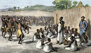
Speke entertained by the King of Uganda, 1861King Mutesa I of Uganda reviewing his troops, a woodcut from Spekes journal, 1864. Hand-colored woodcut of a 19th-century illustration
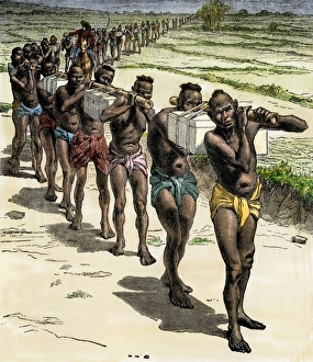
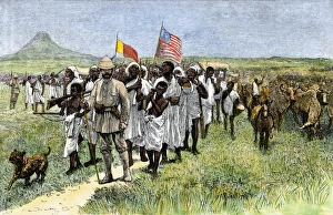
Henry Stanley leading an African expedition, 1870sStanleys expedition marching toward Muta Nzege near Mount Ruwenzori, 1870s. Hand-colored woodcut of a 19th-century illustration
India coast, 1459The Malabar coast of India, from Fra Mauros map, 1459 (south is at the top). Digitally colored woodcut reproduction
EXPL2A-00350French map of the Great Lakes and upper Mississippi River region, circa 1700. Hand-colored 19th-century woodcut reproduction
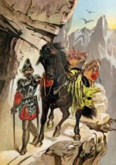
EXPL2A-00031Francisco Pizarro expedition ascending the Andes to conquer the Inca empire in Peru. Printed color lithograph of a 19th-century illustration
Isthmus of Panama, 1744Map from Oexmelins Histoire of the Isthmus of Panama, 1744. Hand-colored woodcut
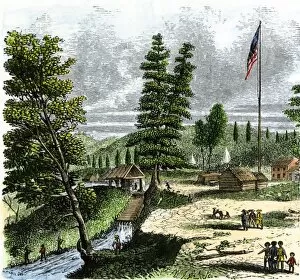
EVNT2A-00096Sutters Mill, site of James Marshalls discovery of gold in California, 1848. Hand-colored woodcut of a 19th-century illustration
Cape of Good Hope mapped at its correct latitude, 1508First map showing Africas southern point at the correct latitude, from Ruysch 1508. Hand-colored woodcut reproduction of a 16th-century illustration
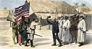
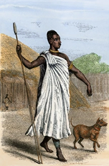
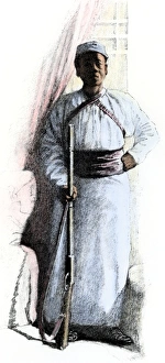
Stanleys African servant, 1880sSali, African servant of explorer Henry Stanley throughout the 1887-1889 expedition and in Cairo. Hand-colored halftone reproduction of a 19th-century illustration