mail_outline sales@mediastorehouse.com
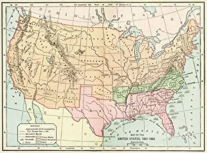
United States during the Civil WarMap of the United States 1861 to 1865. Printed color lithograph of a 19th-century illustration
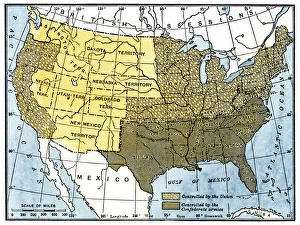
Civil War territory map, 1861Map showing Confederate-held territory at the end of 1861. Hand-colored woodcut of a 19th-century illustration
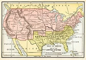
EVCW2A-00009Map of the United States in 1861, at the start of the Civil War. Printed color lithograph 19th century