mail_outline sales@mediastorehouse.com
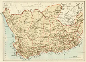
Map of Cape Colony, South AfricaSouth Africa when a British colony, 1870s. Printed color lithograph of a 19th-century illustration
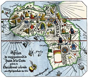
Vasco da Gamas route around Africa, 1400sAfrica as known after Vasco da Gamas discoveries, from map of Juan de la Cosa, 1500. Hand-colored woodcut reproduction
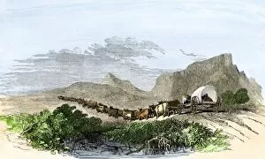
GAFR2A-00028Cape of Good Hope wagon drawn by oxen, South Africa, 1800s. Hand-colored woodcut of a 19th-century illustration
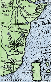
Cape of Good Hope mapped at its correct latitude, 1508First map showing Africas southern point at the correct latitude, from Ruysch 1508. Hand-colored woodcut reproduction of a 16th-century illustration