mail_outline sales@mediastorehouse.com
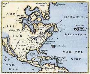
EXPL2A-00375Map of North America as known in the mid-1600s. Hand-colored woodcut reproduction of an illustration in Campanius, 1702
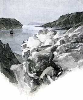
GATL2A-00004Sailing-ship in a Greenland fjord below the end of a glacier. Hand-colored engraving of a 19th-century illustration
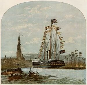
Antwerp welcoming the German prince and princess after their marriage, 1858Prince Frederick William and his bride, Princess Victoria Adelaide, afterward emperor and empress of Germany, arriving in Antwerp, 1858. Color lithograph
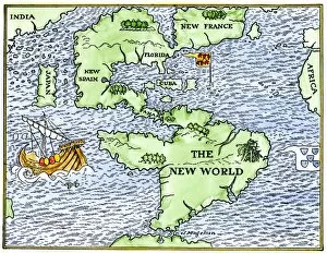
EXPL2A-00148New World geography according to a mapmaker of 1540. Hand-colored woodcut of a 19th-century illustration
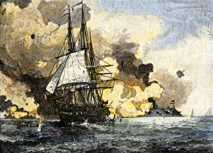
Ironclad Merrimac harrassing Unon shipping, Civil WarConfederate Ironclad " Merrimac" (CSS " Virginia" ) driving the USS " Congress" from anchorage, Civil War. Hand-colored woodcut of a 19th-century illustration
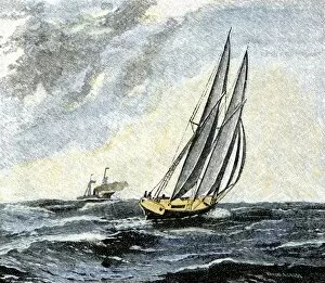
EVCW2A-00020Confederate blockade runner dodging a Union cruiser, US Civil War. Hand-colored halftone of a 19th-century illustration
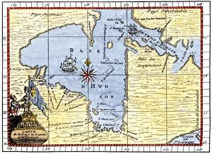
EXPL2A-00190Map of Hudsons Bay, Canada, showing Hudsons Strait, 1722. Hand-colored 19th-century woodcut reproduction of an 18th-century map
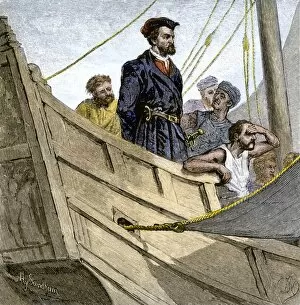
EXPL2A-00232Jacques Cartier aboard ship arriving on the shore of Canada, 1534. Hand-colored woodcut of a 19th-century illustration
EXPL2A-00058Samuel de Champlains map of the Gaspee and Gulf of the Saint Lawrence River, 1632. Hand-colored woodcut reproduction of the original map
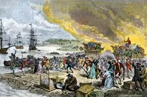
GCAN2A-00001Deportation of the Acadians by the British, 1755. Hand-colored woodcut of a 19th-century illustration
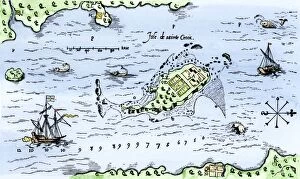
EXPL2A-00296Map of Champlains settlement on the Isle de Sainte Croix, Canada, 1613. Hand-colored 19th-century woodcut reproduction of the original map
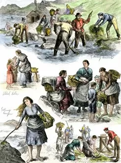
GGBR2A-00010Hungry Irish people gathering seaweed for food, coast of County Clare, 1800s. Hand-colored woodcut of a 19th-century illustration
Swedish slave-ship bringing Africans to the West Indies, 1786Scandinavian slave-ship " Grev Bernstorff" under sail for the West Indies from Africa, 1786. Hand-colored 19th-century woodcut reproduction of an earlier illustration