mail_outline sales@mediastorehouse.com
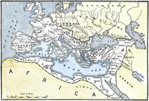
Map of the Roman EmpireMap showing the extent of the Roman Empire. Hand-colored woodcut of a 19th-century illustration
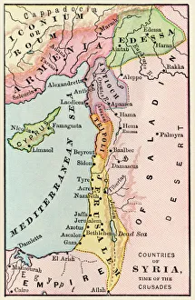
Mideast map during the CrusadesMap of the Middle East at the time of the Crusades. Printed color lithograph
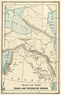
Ancient MesopotamiaMap of the ancient Tigris and Euphrates region. Printed color 19th-century illustration
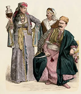
Armenian girl and Syrian menArmenian girl, Druze man, and a man from Damascus. Antique hand-colored print
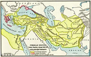
Persian Empire about 500 BCMap of the Persian Empire under Darius I, with principal satrapies, about 500 BC. Color lithograph reproduction of a 19th-century illustration
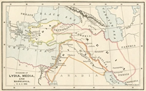
Babylonia, Lydia, and Medea in ancient timesMap of ancient Babylonia and of the kingdoms of Lydia and Medea, circa 550 BC. Printed color lithograph of a 19th-century illustration
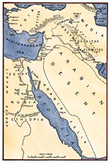
Map of the Mideast in ancient timesMap of the ancient Near East, birthplace of civilization. Hand-colored woodcut of a 19th-century illustration