mail_outline sales@mediastorehouse.com
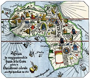
Vasco da Gamas route around Africa, 1400sAfrica as known after Vasco da Gamas discoveries, from map of Juan de la Cosa, 1500. Hand-colored woodcut reproduction
Portuguese traders in India and Ceylon, 1500Calcutta and the southern coast of India, from Juan de la Cosas map, 1500. Hand-colored woodcut reproduction of a 16th-century illustration
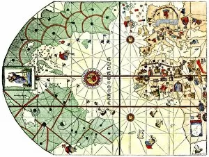
EXPL2A-00024Map of the Atlantic with the New World coast, drawn in 1500 by Juan de la Cosa, Columbus pilot. Hand colored 19th-century woodcut reproduction of the original chart
EXPL2A-00147World map after the disoveries of Columbus and Balboa, showing the prevalent idea that South America was attached to Asia. Hand-colored woodcut of a 19th-century illustration
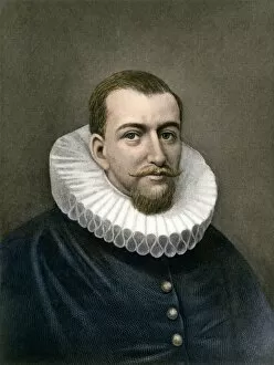
PEXP2A-00024Explorer Henry Hudson. Hand-colored 19th-century engraving
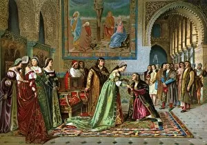
EXPL2A-00069Columbus brought in chains before Ferdinand and Isabella by Bobadilla, 1500. Color lithograph of a 19th-century painting by Jover
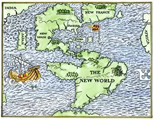
EXPL2A-00148New World geography according to a mapmaker of 1540. Hand-colored woodcut of a 19th-century illustration