mail_outline sales@mediastorehouse.com
118 items
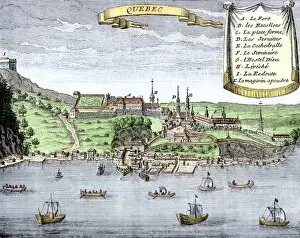
EXPL2A-00025Quebec City and the Saint Lawrence River, 1722. Hand-colored 18th-century woodcut from La Potherie
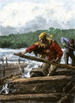
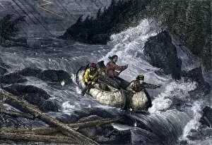
Rafting furs from the northwoods to marketFur traders steering a raft through rapids of a river. Hand-colored woodcut of a 19th-century illustration
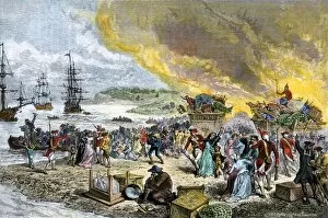
GCAN2A-00001Deportation of the Acadians by the British, 1755. Hand-colored woodcut of a 19th-century illustration
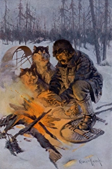
Arctic dog-sledder at his campfireSnowshoe traveler and his Arctic dog-team at a campfire. Printed color halftone reproduction of an illustration by Oliver Kemp
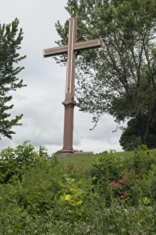
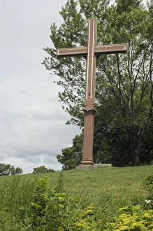
Cartiers landing place on the St. Lawrence, QuebecReplica cross marking Jacques Cartiers landing place on the St Lawrence River in Quebec. Digital photograph
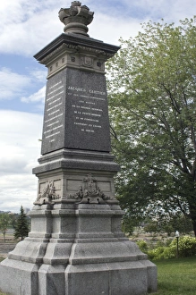
Cartier monument on the St Lawrence, QuebecMonument marking Jacques Cartiers landing place on the St Lawrence River in Quebec. Digital photograph
Cartiers landing place on the St Lawrence, QuebecReplica cross marking Jacques Cartiers landing place on the St Lawrence River in Quebec. Digital photograph
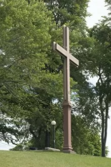
Cartiers landing place on the St Lawrence, QuebecJacques Cartiers landing place on the St Lawrence River in Quebec. Digital photograph
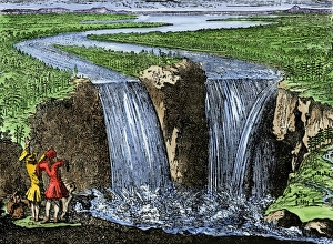
La Salle at Niagara Falls, 1669French explorer La Salle at Niagara Falls, 1669. Hand-colored woodcut of a 19th-century illustration
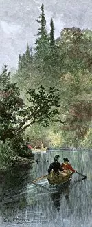
BUSN2A-00204French traders canoeing on a river in the forests of North America. Hand-colored woodcut of a 19th century illustration
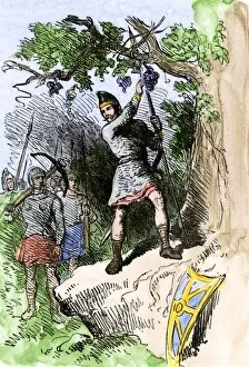
EXPL2A-00306Discovery of grapes by Leif Erikssons expedition, 1001 AD, leading to naming the new land Vinland. Hand-colored woodcut of a 19th-century illustration
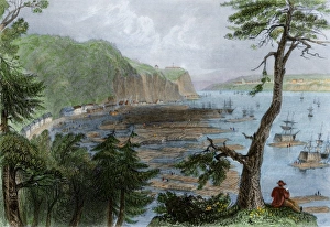
Timber ready to be shipped on the St Lawrence, 1850sTimber depot on the St Lawrence River near Quebec City, 1850s. Hand-colored engraving of a 19th-century illustration
EXPL2A-00297Champlains 1613 map of his settlement at Port Royal, now Annapolis Royal, Nova Scotia, Canada. Hand-colored 19th-century woodcut reproduction of Champlains drawing
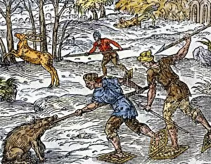
BUSN2A-00152Early settlers hunting on snowshoes in Canada. Hand-colored woodcut
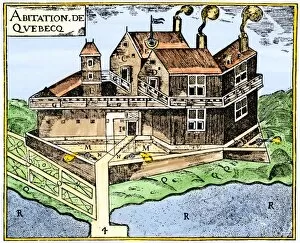
EXPL2A-00295Champlains Quebec fort, 1613, showing the dwellings (C, D), drawbridge (I), Moat (M), cannon (N), garden (O). Hand-colored 19th-century woodcut reproduction of Champlains drawing
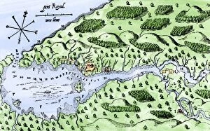
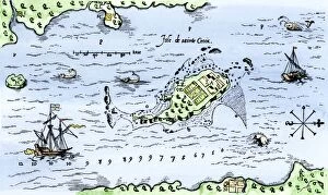
EXPL2A-00296Map of Champlains settlement on the Isle de Sainte Croix, Canada, 1613. Hand-colored 19th-century woodcut reproduction of the original map
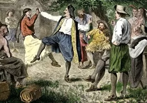
BUSN2A-00166French fur traders and Native Americans dancing at a rendezvous in the north woods. Hand-colored woodcut of a 19th-century illustration
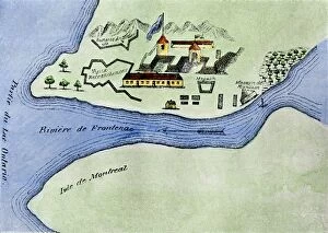
EXPL2A-00267Fort Frontenac on Lake Ontario, 1600s, at the head of the St Lawrence River, now Kingston, Ontario. Hand-colored 19th century halftone reproduction of the original map
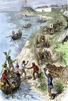
BUSN2A-00125Fur traders arriving at a Hudson Bay Company post in boats and wagons. Hand-colored woodcut of a 19th-century illustration
BUSN2A-00101Fur-traders canoes imperiled by rapids on the Red River of the North. Hand-colored woodcut of a 19th-century illustration
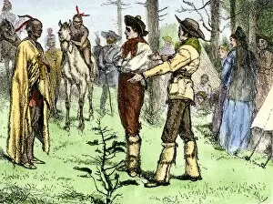
BUSN2A-00096Fur traders and Native Americans conversing in pantomine. Hand-colored woodcut of a 19th-century illustration
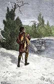
BUSN2A-00060Trapper making his winter rounds in the north wods. Hand-colored woodcut of a 19th-century illustration
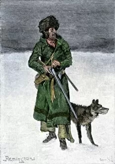
BUSN2A-00020French-Canadian trapper in the snow. Hand-colored 19th-century woodcut of a Frederic Remington illustration
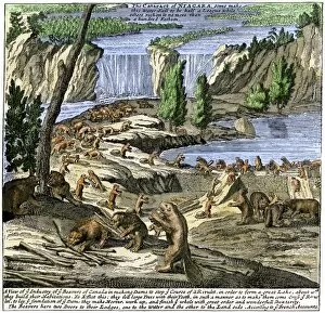
EXPL2A-00356Beavers at work below Niagara Falls, early 1700s. Hand-colored woodcut from Molls New and Exact Map