mail_outline sales@mediastorehouse.com
122 Items
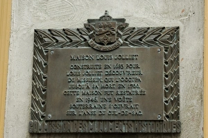
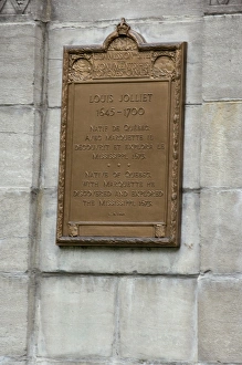
Memorial at Louis Joliets home in old QuebecMemorial plaque, in French, at Louis Joliets home in old Quebec City. Digital photograph
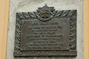
Memorial for Louis Joliets home in old QuebecMemorial plaque, in English, at Louis Joliets home in old Quebec City. Digital photograph
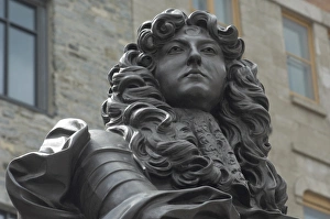
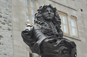
Statue of Louis XIV in old QuebecBust of French King Louis XIV in the historic district of Quebec City, Canada. Digital photograph
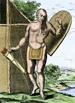
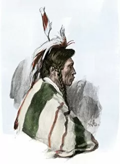
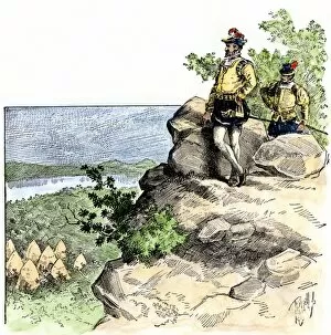
NATI2A-00149A Canadian Native American holding shield, bow, and arrows in a quiver. Hand-colored woodcut
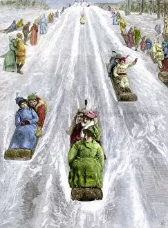
HREC2A-00035Toboggan slide in a park in Montreal, Canada, 1880s. Hand-colored woodcut of a 19th-century illustration
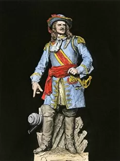
PCAN2A-00001Louis de Buade, Count Frontenac, Governor General of New France, 1600s. Hand-colored woodcut of a 19th-century illustration from a statue
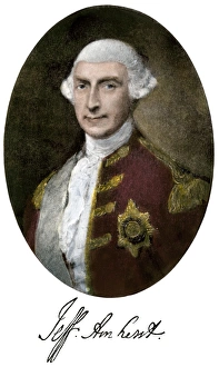
Jeffrey Amherst with his signatureJeffrey Amherst, commander-in-chief of the British army, Governor-General of British North America. Hand-colored halftone reproduction of a portrait
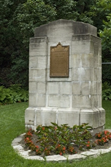
Memorial at Louis Joliets home in old QuebecMemorial in the garden of Louis Joliets home in old Quebec City. Digital photograph
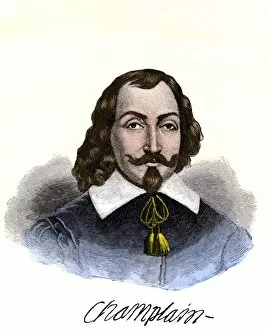
PEXP2A-00074Samuel de Champlain portrait, with his autograph. Hand-colored 19th-century engraving reproduction of the Moncornet portrait
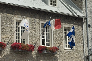
Stone building in the historic district of old QuebecStone building festooned with flags in the historic district of Quebec City. Digital photograph
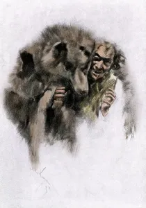
Werewolf of French CanadaLoup-garou, a French-Canadian werewolf legend, 1800s. Hand-colored woodcut of a 19th-century illustration
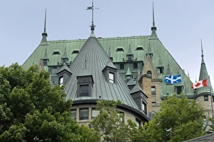
Chateau Frontenac in old QuebecChateau Frontenac in the historic district of Quebec City. Digital photograph
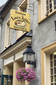
Home of Louis Joliet in old QuebecEntrance to the home of Louis Joliet in the Petit Champlain district of old Quebec City. Digital photograph
NATI2A-00121Cree Indian of the Minnesota - Canada borderlands, 1800s. Hand-colored halftone reproduction of a 19th-century illustration
Louis Joliet memorial plaque in old QuebecMemorial ifor Louis Joliet in old Quebec City. Digital photograph
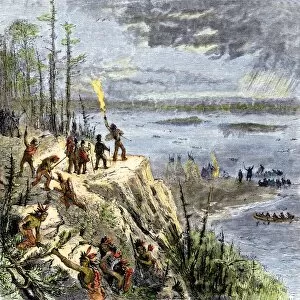
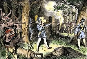
EXPL2A-00109Samuel de Champlain and his Huron allies going to fight the Iroquois, Lake Champlain, 1600s. Hand-colored woodcut of a 19th-century illustration
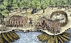
EXPL2A-00110Samuel de Champlains defeat of the Iroquois at Lake Champlain, opening the settlement of New France, 1600s. Hand-colored woodcut
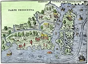
EXPL2A-00126Map of New France, 1550, showing the coast of Canada and the Gulf of Saint Lawrence Hand-colored woodcut
EXPL2A-00183Samuel de Champlains fortified camp at Quebec on the St Lawrence River, 1600s Hand-colored 19th-century woodcut of a 17th-century map
EXPL2A-00186Samuel de Champlain and his Huron Indian allies fighting the Iroquois near Lake Champlain, 1609. Hand-colored woodcut of a 19th-century illustration
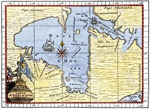
EXPL2A-00190Map of Hudsons Bay, Canada, showing Hudsons Strait, 1722. Hand-colored 19th-century woodcut reproduction of an 18th-century map
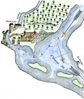
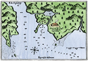
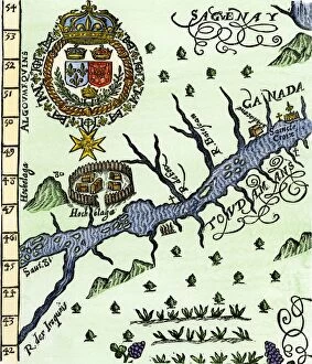
Champlains Tadoussac settlement, 1613Champlains map of Tadoussac settlement in New France, 1613. Hand-colored woodcut of a 17th-century illustration
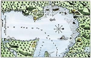
Champlains Quebec settlement, 1613Champlains settlement at Quebec in New France, 1613. Hand-colored woodcut of a 17th-century illustration
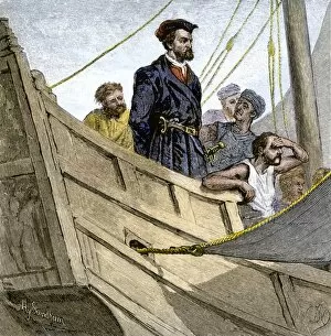
EXPL2A-00232Jacques Cartier aboard ship arriving on the shore of Canada, 1534. Hand-colored woodcut of a 19th-century illustration
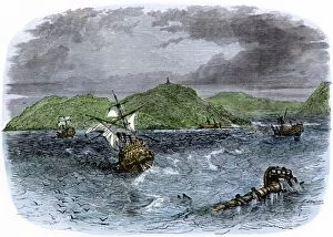
EXPL2A-00231Shipwrecks in the Strait of Belle Isle, Gulf of St Lawrence, Canada. Hand-colored woodcut of a 19th-century illustration
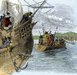
EXPL2A-00234Huron chief Donnacona warns Cartiers expedition not to sail up the St Lawrence River, 1535. Hand-colored woodcut of a 19th-century illustration
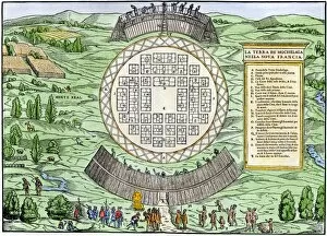
EXPL2A-00246Hochelaga, site of Montreal, shown as a Native American village in Lescarbots map, 1609. Hand-colored 19th-century woodcut reproduction of a 17th-century document
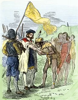
EXPL2A-00247Jacques Cartier embraced by Donnacona, a native Canadian Huron chief, Gaspee Peninsula, 1535. Hand-colored woodcut of a 19th-century illustration
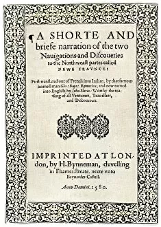
EXPL2A-00251Title page of the London edition of Jacques Cartiers book about his discoveries in Canada, printed in 1580. Watercolor wash over a 19th-century printed halftone reproduction
EXPL2A-00249French colonists building fort at Hochelaga, a native village and the site of Montreal, Canada, 1600s. Hand-colored halftone reproduction of a 17th-century illustration
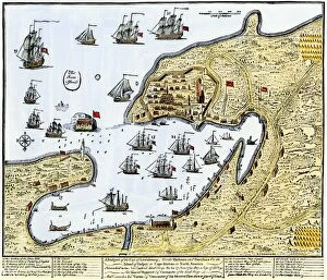
GCAN2A-00016Louisbourg, Canada, besieged by New Englanders under the British flag, 1745. Hand-colored woodcut of a contemporary chart
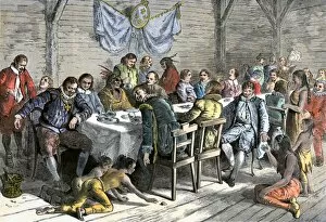
GCAN2A-00014Dining hall of the French colonists at Annapolis Royal, Canada, 1600s. Hand-colored woodcut of a 19th-century illustration
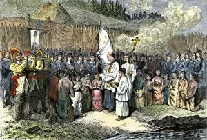
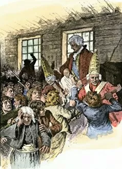
GCAN2A-00013French priest baptising natives at Annapolis Royal, Nova Scotia, 1600s. Hand-colored woodcut of a 19th-century illustration
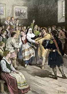
GCAN2A-00012French-Canadians enjoying a dance in early Quebec. Hand-colored woodcut of a 19th-century illustration
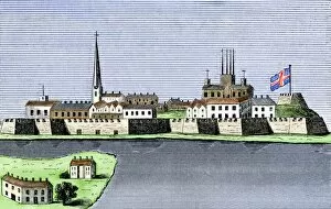
GCAN2A-00011Montreal, Canada, seen from the St. Lawrence River, 1760. Hand-colored woodcut
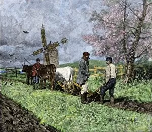
GCAN2A-00008French-Canadian farmers plowing in the Saint Lawrence valley of Quebec, 1800s. Hand colored woodcut of a 19th-century illustration
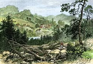
GCAN2A-00007Pioneer settlement on the frontier in Canada, 1800s. Hand-colored woodcut of a 19th-century illustration
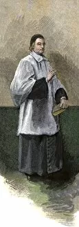
GCAN2A-00006Catholic clergyman of the Order of St. Sulpice, Quebec, Canada, circa 1700. Hand-colored woodcut of a 19th-century illustration
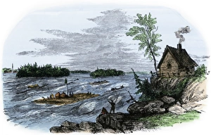
Raft transport on the St Lawrence RiverRafts on the rapids of the St Lawrence River, Canada. Hand-colored woodcut of a 19th-century illustration
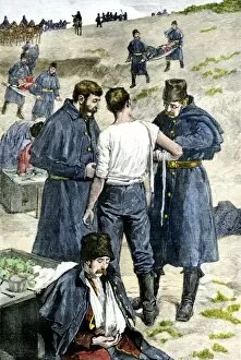
GCAN2A-00004Wounded men carried from a fight with insurgents at Fish Creek during the Riel Rebellion in Canada, 1885. Hand-colored woodcut of a 19th-century illustration
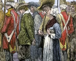
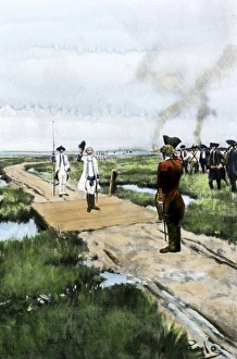
GCAN2A-00003British official reading the Decree of Expulsion to Acadians in Canada, 1755. Hand-colored woodcut of a 19th-century illustration
GCAN2A-00002British removing Acadians from Canada in 1755. Hand-colored woodcut of a 19th-century illustration
EXPL2A-00087Jacques Cartier on the summit of Mont Real, now Montreal, Canada, 1535. Hand-colored woodcut of a 19th-century illustration
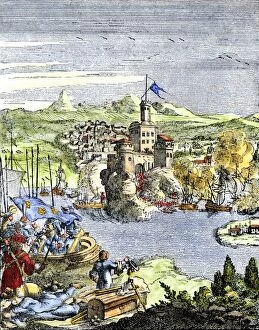
EXPL2A-00080Capture of French Quebec by the English, 1629. Hand-colored woodcut reproduction from Hennepin 1698
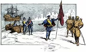
EXPL2A-00085English Explorer John Cabot landing on the shore of Canada, 1484. Hand-colored woodcut of a 19th-century illustration
EXPL2A-00058Samuel de Champlains map of the Gaspee and Gulf of the Saint Lawrence River, 1632. Hand-colored woodcut reproduction of the original map
Surrender of Louisbourg to the English, 1758French surrender of Louisbourg, Canada, French and Indian War, 1758. Hand-colored halftone reproduction of a 19th-century Howard Pyle illustration