Home > American history
EXPL2A-00041

![]()
Wall Art and Photo Gifts from North Wind
EXPL2A-00041
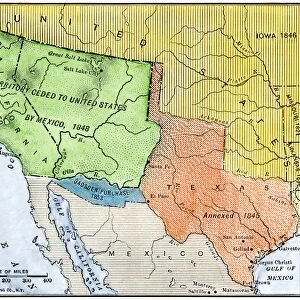
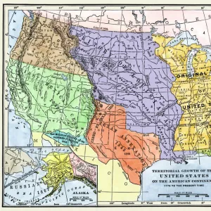
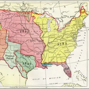
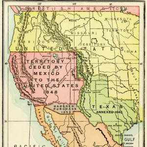
Map of territorial growth of the United States from 1783-1867.
Printed color lithograph of a 19th-century illustration
Media ID 5877456
© North Wind Picture Archives
1700s 1783 18th Century British California Canada Colonial Colony English Expansion French French Canada Frontier Land Claim Louisiana Louisiana Purchase Louisiana Territory Mexican New Spain North West Northwest Territory Old Northwest Oregon Oregon Territory Pacific Northwest Spanish Territory Texas
MADE IN THE UK
Safe Shipping with 30 Day Money Back Guarantee
FREE PERSONALISATION*
We are proud to offer a range of customisation features including Personalised Captions, Color Filters and Picture Zoom Tools
SECURE PAYMENTS
We happily accept a wide range of payment options so you can pay for the things you need in the way that is most convenient for you
* Options may vary by product and licensing agreement. Zoomed Pictures can be adjusted in the Basket.