mail_outline sales@mediastorehouse.com
222 Poster Prints
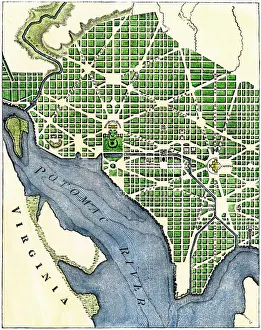
Plan of Washington DC, 1793Washington DC as originally laid out, 1700s. Hand-colored woodcut reproduction of a 1793 engraving
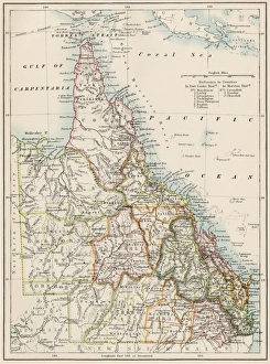
Queensland, Australia, 1800sMap of Queensland, Australia, 1870s. Color lithograph reproduction of a 19th-century illustration
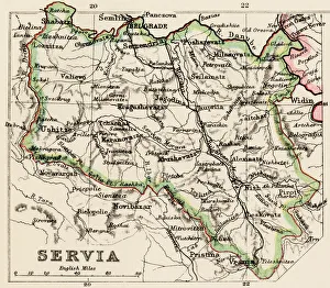
Serbia mapMap of Servia in the 1870s. Printed color lithograph reproduction of a 19th-century illustration
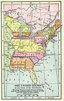
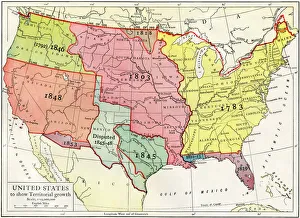
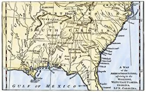
EXPL2A-00164Map of the United States at the close of the American Revolution, 1783. Printed color lithograph of a 19th-century illustration
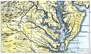
Virginia and Maryland settled in 1738Portions of Maryland and Virginia settled in 1738. Hand-colored 19th-century woodcut reproduction of a document
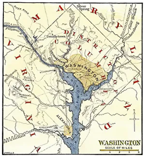
Washington DC during the Civil WarMap of the Washington DC vicinity at the outset of the Civil War. Hand-colored woodcut of a 19th century-illustration
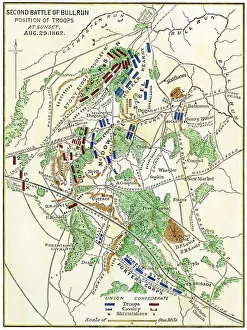
Map of the Second Battle of Bull Run, 1862Bull Run battlefield map showing troop positions on August 29, 1862. Hand-colored woodcut of a 19th-century illustration
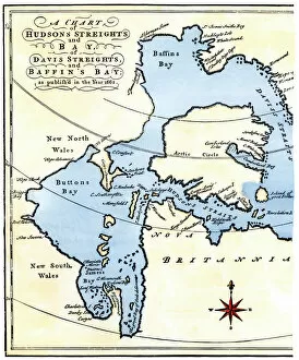
EXPL2A-00284Early map of Hudsons Strait and Hudsons Bay, 1662, in Arctic Canada. Hand-colored 19th-century woodcut reproduction
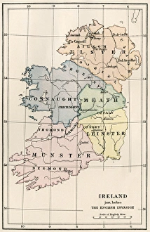
Ireland in the 16th centuryMap of Ireland before the English invasion, circa 1580. Color lithograph reproduction of a 19th-century illustration
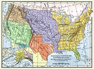
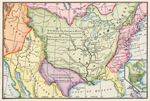
US territorial acquisition during the 1800sMap showiing the territorial growth of the continental US 1776 to 1899. Hand-colored woodcut of a 19th-century illustration
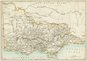
Victoria province, Australia, 1800sMap of Victoria, Australia, 1870s. Color lithograph reproduction of a 19th-century illustration
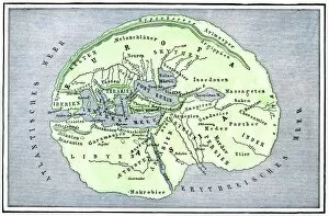
EXPL2A-00138Map of the flat earth according to Herodotus, ancient Greek historian. Hand-colored woodcut of a 19th-century illustration
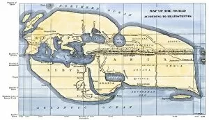
EXPL2A-00317Map of the world according to ancient Greek geographer Eratosthenes. Hand-colored 19th-century woodcut reproduction
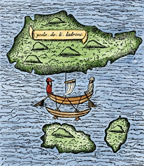
Mariana Islands in the Pacific discovered by Magellan, 1521The Ladrones, later called the Marianas, and a native outrigger drawn by Pigafetta on the Magellan expedition, 1521. Hand-colored woodcut reproduction of a 16th-century illustration
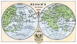
Behaims 1492 globe showing a round Earth but no New WorldDiagram of globe by Martin Behaim, without the New World, created in 1492. Hand-colored woodcut of a 19th-century illustration
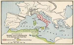
Rome and Carthage, 264 BCTerritories of Rome and Carthage at the outset of the Punic Wars, 264 BC. Color lithograph
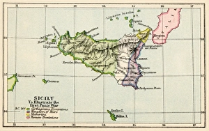
Sicily during the First Punic War, 264 BC. Color lithograph
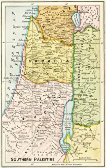
Southern Palestine in ancient timesMap of southern Palestine in ancient times. Printed color lithograph of a 19th-century illustration
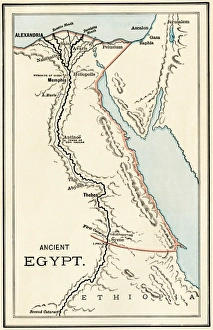
Map of ancient Egypt. Printed color lithograph
Growth of the United States to 1853U.S. map, showing territorial growth to 1853. Printed color lithograph of a 19th-century illustration
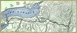
Erie Canal routeMap of the Erie Canal across New York state, 1800s. Hand-colored woodcut of a 19th-century illustration
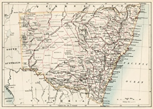
New South Wales map, 1800sMap of New South Wales, Australia, 1870s. Color lithograph reproduction of a 19th-century illustration
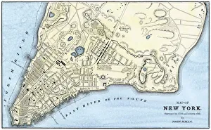
Manhattan map, 1780sJohn Hills map of New York City, surveyed in 1782, drawn in 1785. Hand-colored woodcut reproduction of an 18th-century illustration
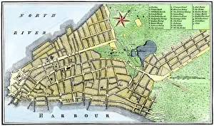
New York City map, 1767Map of New York City in 1767. Hand-colored woodcut of an 18th-century illustration
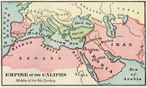
Arab empire, mid-700sEmpire of the Arab Caliphs, middle of the 8th century. Printed color lithograph
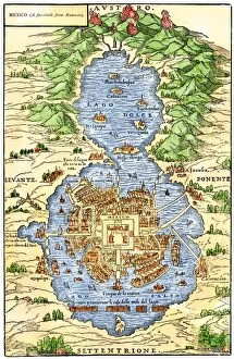
EXPL2A-00294Tenochtitlan, capital city of Aztec Mexico, an Island connected by causeways to land, 1520s. Hand-colored 19th-century woodcut reproduction of an early Spanish colonial map
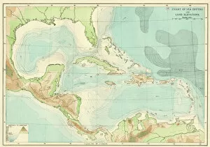
EXPL2A-00377Chart of the West Indies sea depths and land elevations. Printed color lithograph of a 19th-century illustration
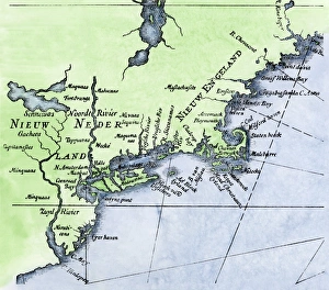
Dutch map of New Netherland and New EnglandNew Netherland and New England, circa 1630. Hand-colored 19th-century woodcut reproduction of DeLaets map
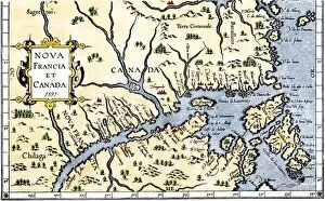
EXPL2A-00325Map of New France and Canada, 1597. Hand-colored 19th-century woodcut reproduction of a 16th-century map printed in Wytfliet
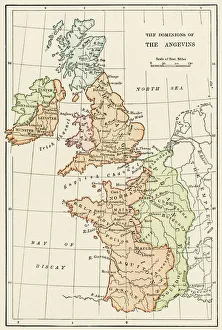
Angevin kings holdings in France and BritainBritish Isles and France under the Angevins, 1100s-1400s. Color lithograph reproduction of a 19th-century illustration
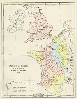
Map of England and France, 1154England and France at the accession of Henry II, 1154. Color lithograph reproduction of a 19th-century illustration
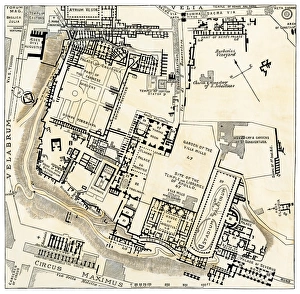
Ancient Romes center, Palatine HillMap of Palatine Hill, city center of ancient Rome. Hand-colored woodcut of a 19th-century illustration
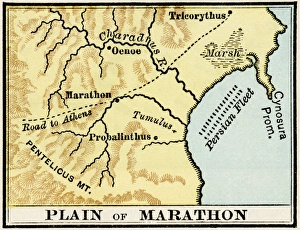
Plain of Marathon in ancient GreeceMap showing the Plain of Marathon, site of the battle in 490 BC. Color lithograph of a 19th-century illustration
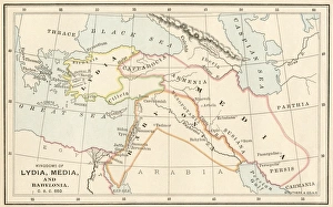
Babylonia, Lydia, and Medea in ancient timesMap of ancient Babylonia and of the kingdoms of Lydia and Medea, circa 550 BC. Printed color lithograph of a 19th-century illustration
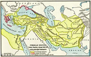
Persian Empire about 500 BCMap of the Persian Empire under Darius I, with principal satrapies, about 500 BC. Color lithograph reproduction of a 19th-century illustration
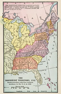
Northwest Territory mapMap of the old Northwest Territory, 1787. Printed color lithograph of a 19th-century illustration
North American colonies in 1733European claims in North America in 1733, when the last English colony, Georgia, was founded. Color lithograph
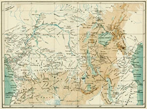
EXPL2A-00366Map of equatorial Africa as known in the 1870s. Printed color lithograph, 19th century
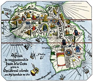
Vasco da Gamas route around Africa, 1400sAfrica as known after Vasco da Gamas discoveries, from map of Juan de la Cosa, 1500. Hand-colored woodcut reproduction
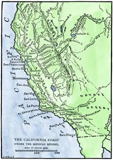
California under Mexican rule, 1800sMap of Alta California under Mexican government, early 1800s. Hand-colored woodcut of a 19th-century illustration
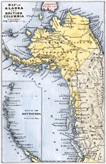
Alaska and British Columbia map, 1872Map of Alaska, the Aleutian Islands, and British Columbia, 1872. Hand-colored woodcut of a 19th-century illustration
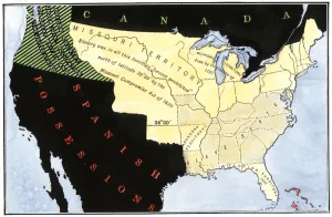
US after the Missouri Compromise, 1820Slave and free territories in the United States after the Missouri Compromise Act, 1820. Hand-colored woodcut of a 19th-century illustration
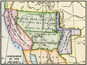
Western US after the Compromise of 1850Map showing the western US territories after the Compromise of 1850. Printed color lithograph of a 19th-century illustration
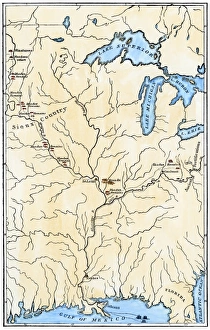
Map of Mandan migrationCaitlins map showing the moves of the Mandans and the place of their extinction, 1837. Hand-colored woodcut of a 19th-century illustration
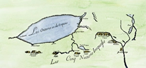
Iroquois Nations map, 1600sFrench map of the Five Iroquois Nations homeland and Fort Orange (Albany), 1660s. Hand-colored woodcut of a 17th-century illustration
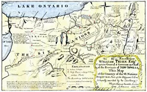
NATI2A-00044Map of the Six Iroquois Nations in Pennsylvania and New York, 1771. Hand-colored woodcut reproduction of an 18th-century document
Southeast Indian tribe locations in 1776Map of southeastern Native American Nations about 1776. Hand-colored woodcut
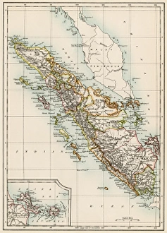
Sumatra, 1800sMap of Sumatra, 1870s. Color lithograph of a 19th-century illustration