mail_outline sales@mediastorehouse.com
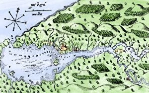
EXPL2A-00297Champlains 1613 map of his settlement at Port Royal, now Annapolis Royal, Nova Scotia, Canada. Hand-colored 19th-century woodcut reproduction of Champlains drawing
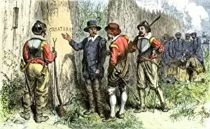
Governor White finds Roanoke Colony abandoned, 1591Roanoke Colony abandoned without a trace except " Croatoan" carved on a tree, 1591. Hand-colored woodcut of a 19th-century illustration
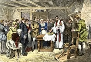
Virginia Dare baptised on Roakoke Island, 1585Baptism of Virginia Dare, the first English child born in the New World, Roanoke Colony, 1587. Hand-colored woodcut of a 19th-century illustration
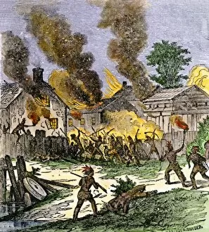
EVNT2A-00153Colonial village of Brookfield, Massachusetts burned by Native Americans during King Phillips War 1675. Hand-colored woodcut of a 19th-century illustration
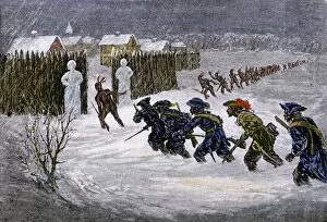
EVNT2A-00182French and Indian attack on Schenectady, New York, during the winter of 1689-1690. Hand-colored woodcut of a 19th-century illustration
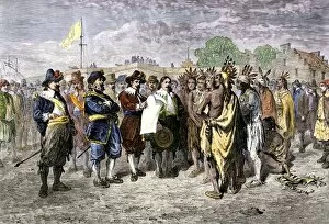
Mohawks and New Netherland colonists agree to a truceDutch treaty with the Mohawks at Fort Amsterdam, 1640s. Hand-colored woodcut of a 19th-century illustration
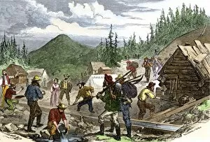
EVNT2A-00242Prospectors working the Gregory gold diggings in the Colorado Rockies, May 1859. Hand-colored woodcut of a 19th-century illustration
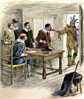
EVNT2A-00238Declaration of war by a Pequot Indian delivering an arrow to Massachusetts Bay colonists, 1636. Hand-colored woodcut of a 19th-century illustration
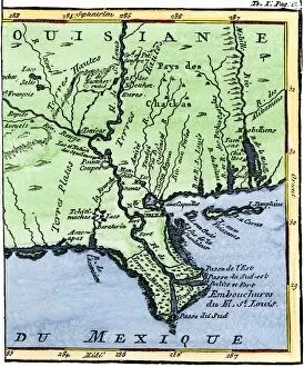
EXPL2A-00302Map of Louisiana, 1744, showing the mouths of the Mississippi River while part of New France. Hand-colored woodcut reproduction of the map
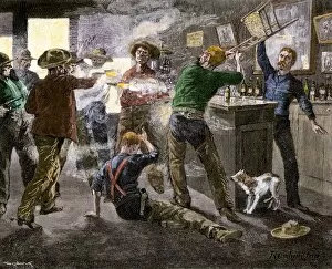
HSET2A-00032Saloon brawl in a cattle town, western U.S. Hand-colored woodcut of a 19th-century illustration by Frederic Remington
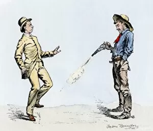
Western gunfighter making his victom " dance." Hand-colored woodcut of a 19th-century Frederic Remington illustration
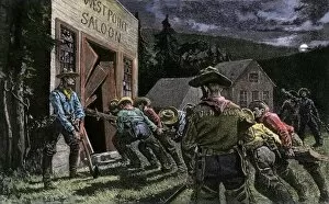
Miners smashing into a saloonWestern miners smashing into a saloon. Hand-colored woodcut of a 19th-century illustration
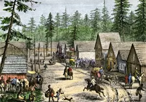
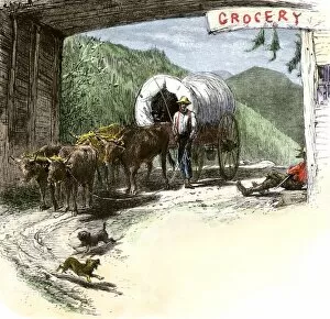
HSET2A-00124New settlers in a frontier town in the Pacific Northwest, 1800s. Hand-colored woodcut of a 19th-century illustration
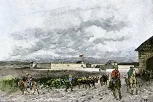
EVNT2A-00158Sutters Fort in the 1840s when it became the center of the California Gold Rush. Hand-colored engraving of a 19th-century illustration
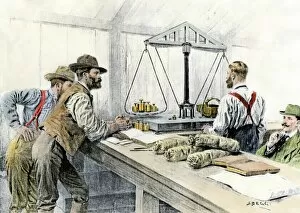
EVNT2A-00114Klondike miners weighing their gold in a Dawson City bank, 1898. Hand-colored halftone of a 19th century illustration
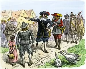
Guthrie, Oklahoma, opened to settlers, 1889Settlers claiming lots in Guthrie, Oklahoma, 20 minutes after the first train arrived, 1889. Hand-colored woodcut of a 19th-century illustration
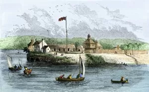
Fort Howard, Green Bay, WisconsinFort Howard, US Army outpost on the Wisconsin frontier in the early 1800s, Heritage Hill, Green Bay. Photograph
Mississippi River boats passing Fort ArmstrongFort Armstrong on Rock Island in the Mississippi River, 1850s. Hand-colored woodcut of a 19th-century illustration
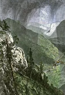
HSET2A-00016Covered wagon coming through Cumberland Gap, viewed from Eagle Cliff, 1800s. Hand-colored woodcut of a 19th-century illustration
HSET2A-00022Covered wagon entering Kentucky through Cumberland Gap. Hand-colored woodcut of a 19th-century illustration
PUSA2A-00070New Netherlands Governor Kieft lecturing his subjects on tobacco, 1600s. Hand-colored halftone reproduction of a 19th-century illustration
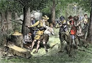
EVNT2A-00145Virginia colonists under attack by Native Americans, 1600s. Hand-colored woodcut of a 19th-century illustration
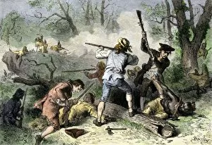
EVNT2A-00146Colonists conflict with Native Americans on the Georgia and Carolina frontier, 1700s. Hand-colored woodcut of a 19th-century illustration
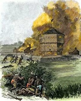
EVNT2A-00036Attack on Fort King by Native Americans under Osceola during the Seminole Wars, 1835. Hand-colored woodcut of a 19th century illustration
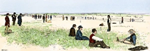
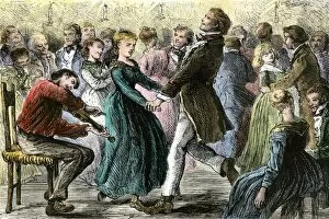
HREC2A-00009Couples dancing to music of a fiddler at a rural hoedown, 1800s. Hand-colored woodcut of a 19th-century illustration
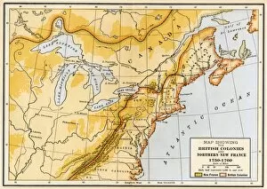
EVNT2A-00019Map showing British colonies and northern New France during the French and Indian War, 1750s. Printed color lithograph of a 19th century illustration
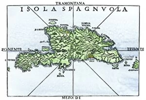
EXPL2A-00227Map of Hispaniola in 1534, from cartography of Peter Martyr and Oviedo. Hand-colored 19th-century woodcut reproduction of a 16th-century map
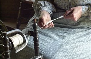
Norwegian immigrant homestead, Old World WisconsinNorwegian immigrant farm woman reenactor spinning wool in the Kvaale House, built circa 1848, at Old World Wisconsin, Eagle WI. Digital photograph
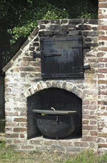
Colonial oven, Charleston, South CarolinaOutdoor oven, Charles Towne Landing Historic Site, reconstructed settlement, South Carolina. Digital photograph
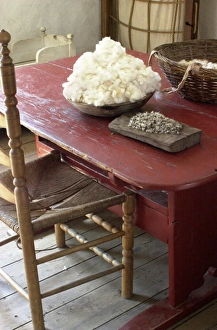
Cotton cleaned by hand, South CarolinaCotton to be cleaned, Charles Towne Landing colonial historic site, South Carolina. Digital photograph
PEXP2A-00026Antoine de La Mothe, Sieur de Cadillac landing on the shore of Lake Saint Clair where he founded Fort Detroit, 1701. Hand colored woodcut of a 19th-century illustration by Howard Pyle
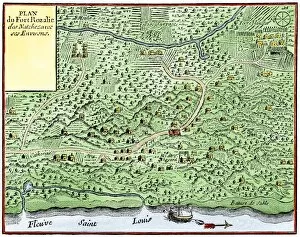
EXPL2A-00124Fort Rozalie des Natchez on the Mississippi River 1700s - North is to the right. Hand-colored woodcut of a map published in 1770. Fleuve Saint Louis was the French name for the Mississippi River
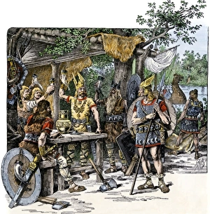
Vikings in the New WorldNorsemen celebrating their discovery of the New World. Hand-colored woodcut of a 19th-century illustration
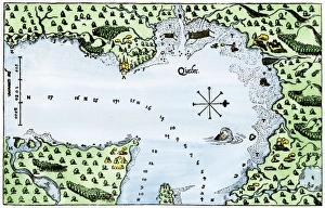
EXPL2A-00183Samuel de Champlains fortified camp at Quebec on the St Lawrence River, 1600s Hand-colored 19th-century woodcut of a 17th-century map
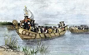
Champlains Quebec settlement, 1613Champlains settlement at Quebec in New France, 1613. Hand-colored woodcut of a 17th-century illustration
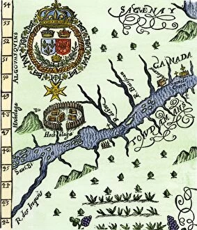
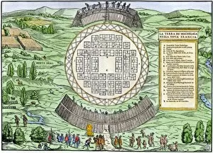
EXPL2A-00246Hochelaga, site of Montreal, shown as a Native American village in Lescarbots map, 1609. Hand-colored 19th-century woodcut reproduction of a 17th-century document
EXPL2A-00249French colonists building fort at Hochelaga, a native village and the site of Montreal, Canada, 1600s. Hand-colored halftone reproduction of a 17th-century illustration
GCAN2A-00007Pioneer settlement on the frontier in Canada, 1800s. Hand-colored woodcut of a 19th-century illustration
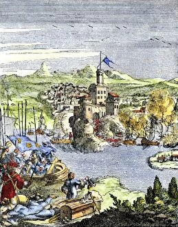
EXPL2A-00080Capture of French Quebec by the English, 1629. Hand-colored woodcut reproduction from Hennepin 1698
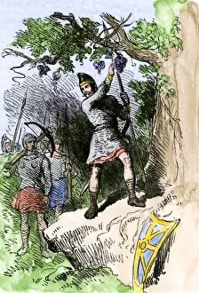
EXPL2A-00306Discovery of grapes by Leif Erikssons expedition, 1001 AD, leading to naming the new land Vinland. Hand-colored woodcut of a 19th-century illustration
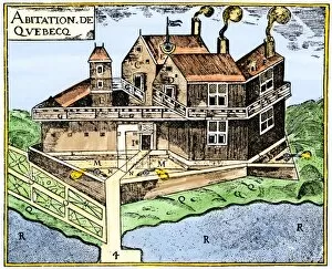
EXPL2A-00295Champlains Quebec fort, 1613, showing the dwellings (C, D), drawbridge (I), Moat (M), cannon (N), garden (O). Hand-colored 19th-century woodcut reproduction of Champlains drawing
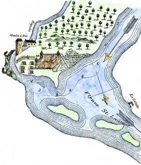
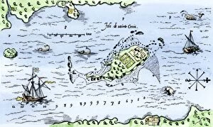
EXPL2A-00296Map of Champlains settlement on the Isle de Sainte Croix, Canada, 1613. Hand-colored 19th-century woodcut reproduction of the original map
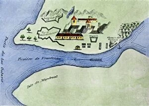
EXPL2A-00267Fort Frontenac on Lake Ontario, 1600s, at the head of the St Lawrence River, now Kingston, Ontario. Hand-colored 19th century halftone reproduction of the original map
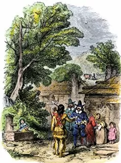
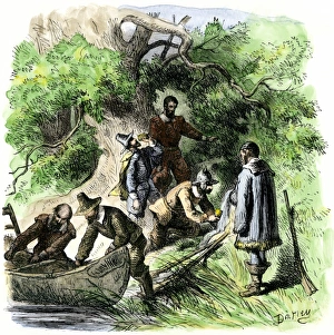
Squanto befriends the colonists at Plymouth, 1620s" Welcome, Englishmen, " Squanto greets the Pilgrims of Plymouth Colony. Hand-colored woodcut of a 19th-century illustration
Founding of Providence, Rhode Island, 1636Roger Williams landing at a spring where he builds Providence, Rhode Island, 1636. Hand-colored woodcut of a 19th-century illustration
PUSA2A-00071Peter Stuyvesant at Fort Orange ( now Albany), New Netherland, 1648. Hand-colored woodcut of a 19th-century illustration
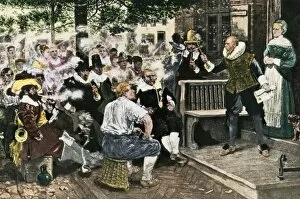
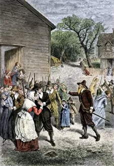
EVNT2A-00148Goffe rallying the colonists of Hadley, Massachusetts, during King Philips War, 1670s. Hand-colored woodcut of a 19th-century illustration
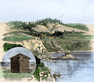
Fort Ross and a Russian blockhouse, CaliforniaFort Ross on the California coast, and an old Russian blockhouse (inset). Hand-colored woodcut of a 19th-century illustration