mail_outline sales@mediastorehouse.com
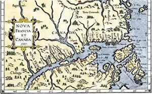
EXPL2A-00325Map of New France and Canada, 1597. Hand-colored 19th-century woodcut reproduction of a 16th-century map printed in Wytfliet
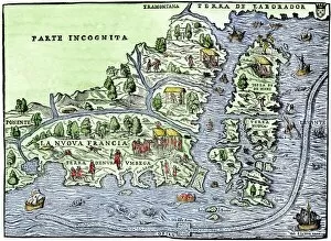
EXPL2A-00126Map of New France, 1550, showing the coast of Canada and the Gulf of Saint Lawrence Hand-colored woodcut
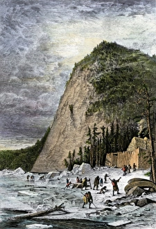
French fort at Quebec as a winter refuge, 1600sStarving Native Americans seeking refuge at the French fort at Quebec, Canada, 1600s. Hand-colored woodcut of a 19th-century illustration
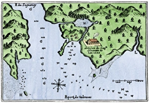
Champlains Tadoussac settlement, 1613Champlains map of Tadoussac settlement in New France, 1613. Hand-colored woodcut of a 17th-century illustration
Ice-cutting in Quebec, 1850sSawing and harvesting ice on the St. Lawrence River, 1850s. Hand-colored woodcut of a 19th-century illustration
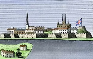
GCAN2A-00011Montreal, Canada, seen from the St. Lawrence River, 1760. Hand-colored woodcut
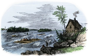
Raft transport on the St Lawrence RiverRafts on the rapids of the St Lawrence River, Canada. Hand-colored woodcut of a 19th-century illustration
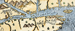
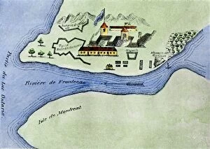
Quebec and Tadoussac, 1609Lescarbots map of the St. Lawrence and the Saguenay showing Quebec (Kebec) in Canada, 1609. Hand-colored woodcut of a 19th-century illustration
Champlains Quebec settlement, 1613Champlains settlement at Quebec in New France, 1613. Hand-colored woodcut of a 17th-century illustration
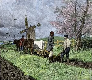
GCAN2A-00008French-Canadian farmers plowing in the Saint Lawrence valley of Quebec, 1800s. Hand colored woodcut of a 19th-century illustration
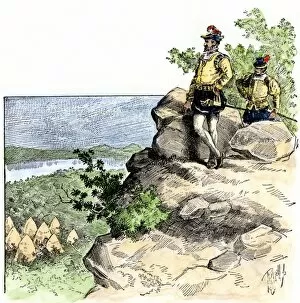
EXPL2A-00087Jacques Cartier on the summit of Mont Real, now Montreal, Canada, 1535. Hand-colored woodcut of a 19th-century illustration
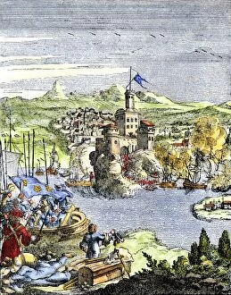
EXPL2A-00080Capture of French Quebec by the English, 1629. Hand-colored woodcut reproduction from Hennepin 1698
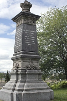
Cartier monument on the St Lawrence, QuebecMonument marking Jacques Cartiers landing place on the St Lawrence River in Quebec. Digital photograph
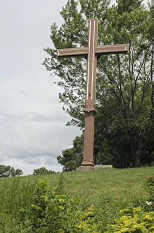
Cartiers landing place on the St Lawrence, QuebecReplica cross marking Jacques Cartiers landing place on the St Lawrence River in Quebec. Digital photograph
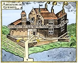
EXPL2A-00295Champlains Quebec fort, 1613, showing the dwellings (C, D), drawbridge (I), Moat (M), cannon (N), garden (O). Hand-colored 19th-century woodcut reproduction of Champlains drawing
EXPL2A-00267Fort Frontenac on Lake Ontario, 1600s, at the head of the St Lawrence River, now Kingston, Ontario. Hand-colored 19th century halftone reproduction of the original map