mail_outline sales@mediastorehouse.com
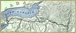
Erie Canal routeMap of the Erie Canal across New York state, 1800s. Hand-colored woodcut of a 19th-century illustration
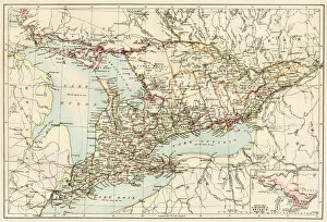
Ontario, 1870sMap of Ontario, Canada, 1870s. Printed color lithograph
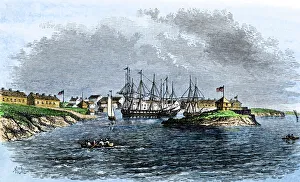
US Navy base at Sackets Harbor, NY, 1814Sackets Harbor on Lake Ontario in 1814, a US Naval station in the War of 1812. Hand-colored woodcut of a 19th century illustration
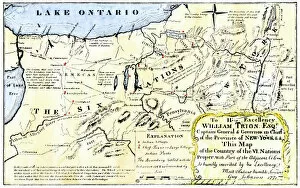
NATI2A-00044Map of the Six Iroquois Nations in Pennsylvania and New York, 1771. Hand-colored woodcut reproduction of an 18th-century document
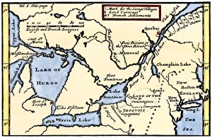
French map of the Great Lakes, 1703La Hontans map of the Great Lakes and Saint Lawrence valley, 1703. Hand-colored 19th-century woodcut reproduction of an 18th century illustration
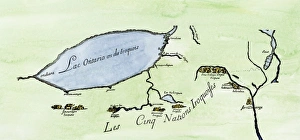
Iroquois Nations map, 1600sFrench map of the Five Iroquois Nations homeland and Fort Orange (Albany), 1660s. Hand-colored woodcut of a 17th-century illustration
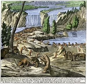
EXPL2A-00356Beavers at work below Niagara Falls, early 1700s. Hand-colored woodcut from Molls New and Exact Map
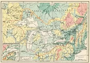
EXPL2A-00357Map of the Great Lakes and the St. Lawrence watershed. Printed color lithograph, 19th century
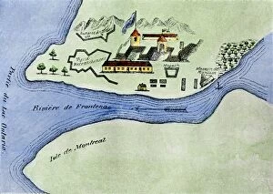
EXPL2A-00267Fort Frontenac on Lake Ontario, 1600s, at the head of the St Lawrence River, now Kingston, Ontario. Hand-colored 19th century halftone reproduction of the original map