mail_outline sales@mediastorehouse.com
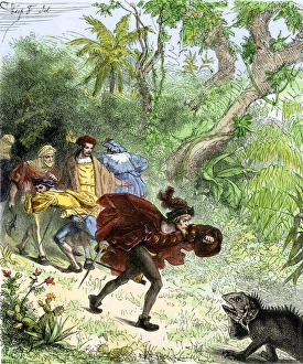
Columbus encountering an iguana when he was ashore in the New World. Hand-colored woodcut of a 19th-century illustration
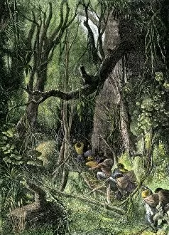
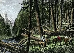
EXPL2A-00130Exploring a tropical rain forest, such as in Central or South America. Hand-colored woodcut of a 19th-century illustration
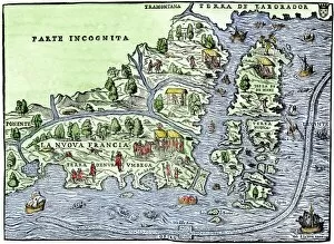
EXPL2A-00126Map of New France, 1550, showing the coast of Canada and the Gulf of Saint Lawrence Hand-colored woodcut
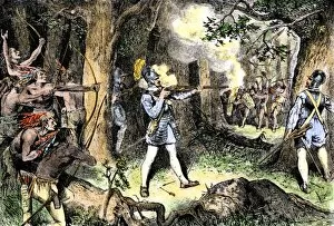
EXPL2A-00186Samuel de Champlain and his Huron Indian allies fighting the Iroquois near Lake Champlain, 1609. Hand-colored woodcut of a 19th-century illustration
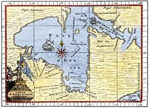
EXPL2A-00190Map of Hudsons Bay, Canada, showing Hudsons Strait, 1722. Hand-colored 19th-century woodcut reproduction of an 18th-century map
EXPL2A-00058Samuel de Champlains map of the Gaspee and Gulf of the Saint Lawrence River, 1632. Hand-colored woodcut reproduction of the original map
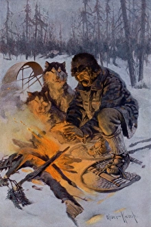
Arctic dog-sledder at his campfireSnowshoe traveler and his Arctic dog-team at a campfire. Printed color halftone reproduction of an illustration by Oliver Kemp
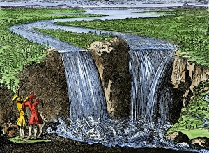
La Salle at Niagara Falls, 1669French explorer La Salle at Niagara Falls, 1669. Hand-colored woodcut of a 19th-century illustration
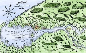
EXPL2A-00297Champlains 1613 map of his settlement at Port Royal, now Annapolis Royal, Nova Scotia, Canada. Hand-colored 19th-century woodcut reproduction of Champlains drawing
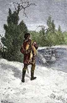
BUSN2A-00060Trapper making his winter rounds in the north wods. Hand-colored woodcut of a 19th-century illustration
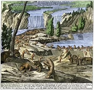
EXPL2A-00356Beavers at work below Niagara Falls, early 1700s. Hand-colored woodcut from Molls New and Exact Map
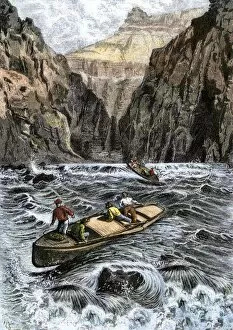
EXPL2A-00144John Wesley Powells Grand Canyon expedition running rapids on the Colorado River, 1870s. Hand colored woodcut from Powells published account 1870s
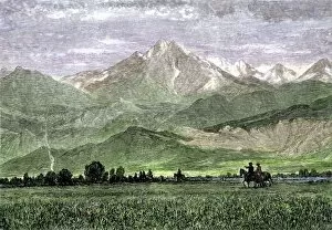
EXPL2A-00250Rocky Mountains with horseback riders in a valley, titled " Kingdom of the West Wind." Hand-colored woodcut of a 19th-century painting
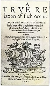
EXPL2A-00237Title page of John Smiths book, " A True Relation... in Virginia... " 1608. Hand-colored 19th-century reproduction of the original document
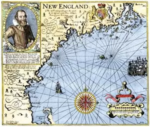
EXPL2A-00291John Smiths map of New England, with inset portrait, circa 1620. Hand-colored 19th-century woodcut reproduction of the original
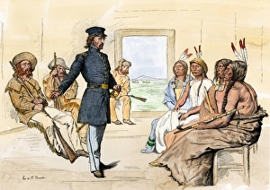
John C. Fremont meeting Plains chiefs at Fort Laramie, 1840sJohn C. Fremont meeting with Native Americans at Fort Laramie, 1840s. Hand-colored woodcut of a 19th-century illustration
EXPL2A-00292Destruction of John Smiths ship by the Spanish, ending his New England venture. Hand-colored woodcut of a 19th-century illustration
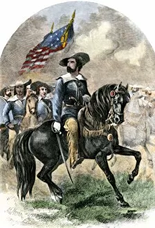
PEXP2A-00043General John C. Fremont in his prairie uniform leading an expedition into western territory. Hand-colored woodcut of a 19th-century illustration
Sir Richard Burton exploring Lake Tanganika, 1858Sir Richard Burton exploring Lake Tanganika, east Africa, 1858. Hand-colored woodcut of a 19th-century illustration
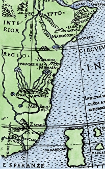
Cape of Good Hope mapped at its correct latitude, 1508First map showing Africas southern point at the correct latitude, from Ruysch 1508. Hand-colored woodcut reproduction of a 16th-century illustration
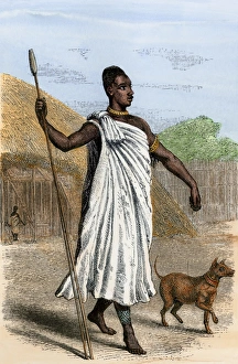
Mutesa I, King of Uganda, as described by John Henning Speke. Hand-colored woodcut from Spekes Journal, 1864
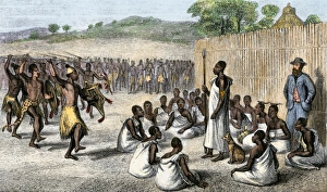
Speke entertained by the King of Uganda, 1861King Mutesa I of Uganda reviewing his troops, a woodcut from Spekes journal, 1864. Hand-colored woodcut of a 19th-century illustration
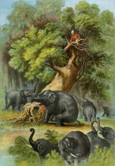
Henry Stanley in AfricaAfrican explorer Henry Stanley attacked by elephants, 1870s. Color lithograph of a 19th-century illustration from Stanleys book, " In Darkest Africa"
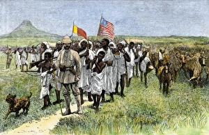
Henry Stanley leading an African expedition, 1870sStanleys expedition marching toward Muta Nzege near Mount Ruwenzori, 1870s. Hand-colored woodcut of a 19th-century illustration
EXPL2A-00204Henry Stanleys expedition dragging a boat around rapids on the Congo river in Africa 1870s. Printed color lithograph of a 19th-century illustration
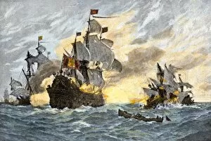
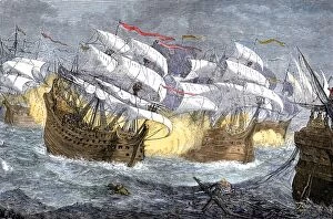
EXPL2A-00075Seizure of Spanish treasure ships by the English fleet of Sir Francis Drake. Hand-colored woodcut of a 19th-century illustration
EXPL2A-00188One of Henry Hudsons ships, early 1600s. Hand-colored 19th-century reproduction of a woodcut from Hudsons " Voyages" published in 1612
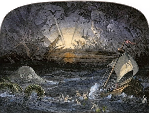
Sea of DarknessTerrors in the Sea of Darkness. Hand-colored woodcut of a 19th-century illustration
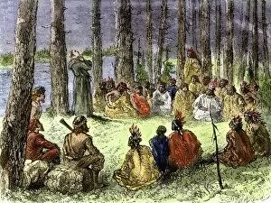
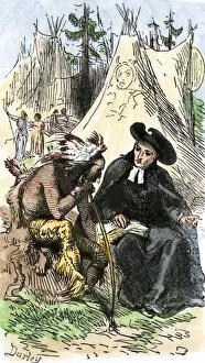
EXPL2A-00175Jesuit missionary preaching to Native Americans and fur traders in the wilderness. Hand-colored woodcut of a 19th-century illustration
EXPL2A-00253French Jesuit missionary in a Native American village. Hand-colored woodcut of a 19th-century illustration
BUSN2A-00066Pack train of traders in the Rocky Mountains, 1800s. Hand-colored woodcut of a 19th-century illustration
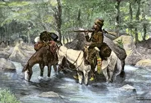
BUSN2A-00036A white trapper crossing a mountain stream. Hand-colored 19th-century woodcut of a Frederic Remington Illustration
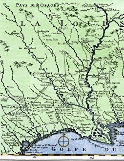
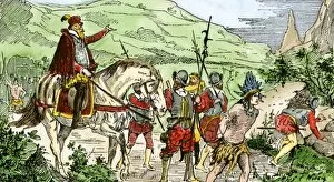
DeSotos route in LouisianaWestern part of De Sotos route, from Desisles map published in 1707. Hand-colored woodcut reproduction of an 18th-century illustration
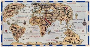
EXPL2A-00354Dauphin Map by Pierre Desceliers made for Prince Henry (who became Henri II) by order of the French King Francis I, 1546. Printed color halftone reproduction 19th century
PEXP2A-00069Nicolas de Ovandos army on Hispaniola setting out for Xaragua, 1500s. Hand-colored woodcut of a 19th-century illustration
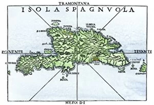
EXPL2A-00227Map of Hispaniola in 1534, from cartography of Peter Martyr and Oviedo. Hand-colored 19th-century woodcut reproduction of a 16th-century map
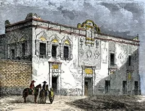
EXPL2A-00276House of Hernando Cortes in Mexico City, built by native labor in the 1500s. Hand-colored woodcut of a 19th-century illustration
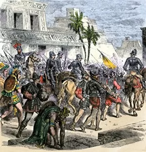
EXPL2A-00368Cortes marches out of Aztec Tenochtitlan to battle the army of Narvaez, 1519. Hand-colored woodcut of a 19th century illustration
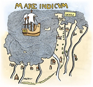
India coast, 1459The Malabar coast of India, from Fra Mauros map, 1459 (south is at the top). Digitally colored woodcut reproduction
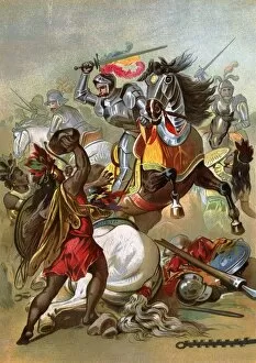
EXPL2A-00076Hernando Cortes loses two horses in battle with Tlaxcalan natives in conquering Mexico, 1519. Printed color lithograph of a 19th century illustration
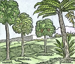
EXPL2A-00100Bananas and other fruit trees of Hispaniola, from a sketch published in 1572. Hand-colored woodcut of a 19th-century reproduction of an illustration from Benzoni 1572
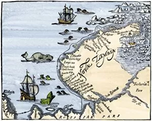
EXPL2A-00346Early map showing Nova Zembla off the Arctic coast of Russia, probably 1600s. Hand-colored 19th-century woodcut reproduction
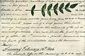
EXPL2A-00168William Clarks sketch of an evergreen shrub leaf in the Lewis and Clark expedition diary, 1806. Hand-colored halftone reproduction of a 19th-century photograph of Clarks handwritten page
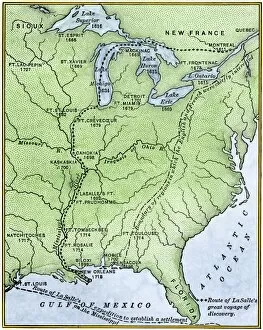
EXPL2A-00171Map showing the route of La Salles explorations in North America, late 1600s. Hand-colored woodcut of a 19th-century illustration
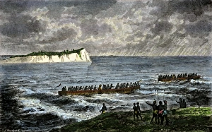
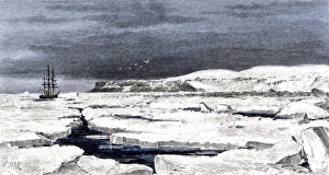
Barents Sea ice around the Eira on its first voyage, 1880Leigh Smiths " Eira" locked in ice during the ships first Arctic voyage off Spitsbergen, 1880. Hand-colored woodcut of a 19th-century illustration
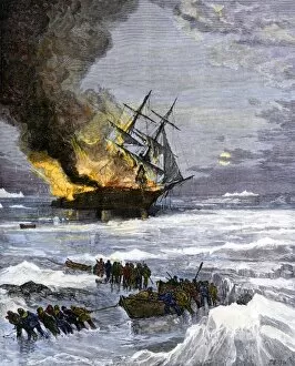
Arctic rescue ship disaster off Siberia, 1882Burning of the US Navy ship " Rodgers" in Arctic waters, hunting for the DeLong expedition after disappearance of the " Jeannette, " 1882
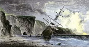
EXPL2A-00180Henry Grinnells ship aground during the search led by Elisha Kent Kane for the lost Sir John Franklin expedition, under the midnight sun, 1853
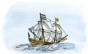
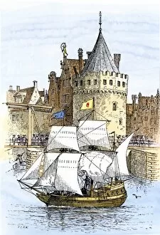
EXPL2A-00189Hudsons ship " Half-Moon" leaving Amsterdam for the New World, 1609. Hand-colored woodcut of a 19th-century illustration