mail_outline sales@mediastorehouse.com
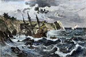
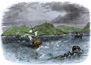
EXPL2A-00036Wreck of Columbuss flagship Santa Maria on the coast of Hispaniola, 1492. Hand-colored woodcut of a 19th-century illustration
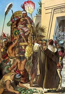
EXPL2A-00030Missionary Father Valverde addresses the Inca king Atahualpa during the Spanish conquest of Peru, 1532. Printed color lithograph of a 19th-century illustration
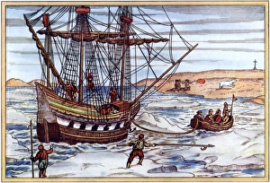
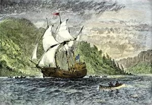
Arctic voyage of Willem Barents, 1500sWillem Barents ship in the Artic ice, 1590s. Printed color woodcut by Gerard de Veer, 1598
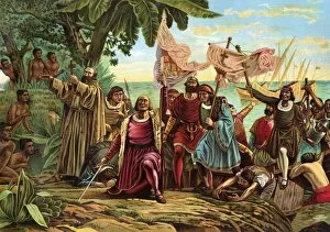
EXPL2A-00066Landing of Columbus expedition on the island of Guanahane in 1492. Printed color lithograph of a 19th-century painting by Dioscoro Puebla
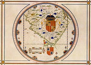
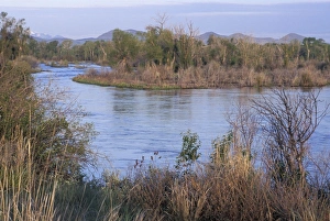
Portuguese map of the tip of South America, 1571Map of South America printed in Lisbon, 1571. Printed color halftone reproduction
EXPL2A-00088Death of Magellan on the island of Mactan, Philippines, in 1521, before completing his circumnavigation of the earth. Hand-colored woodcut of a 19th-century illustration
EXPL2A-00091Henry Hudsons ship " Half-Moon" ascending the Hudson River, 1609. Hand-colored woodcut of a 19th-century illustration
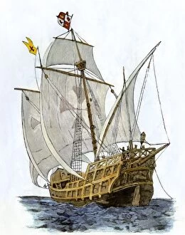
EXPL2A-00089Caravel " Santa Maria, " the flagship of Columbus first voyage and which sank off Hispaniola in 1492. Hand-colored woodcut of a 19th-century illustration
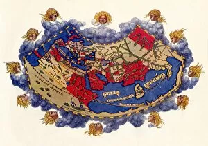
EXPL2A-00061Ptolemys world map, circa 150 AD, from the edition of 1472. Color halftone reproduction of the first printed edition of 1472
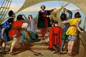
EXPL2A-00055First view of the New World by Columbus and his crew aboard the " Santa Maria, " 1492. Printed color lithograph of a 19th-century illustration
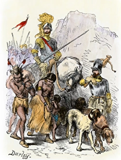
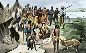
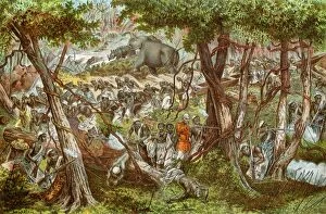
DeSoto with Native American captives, 1539De Soto expedition traveling with captive Native Americans, 1539. Hand-colored woodcut reproduction of a 19th-century Darley illustration
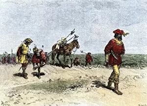
EXPL2A-00163Alvar Nunez Cabeza de Vaca crossing the Great American Desert from Texas to Mexico, early 1500s. Hand-colored woodcut of a 19th-century illustration
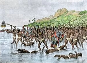
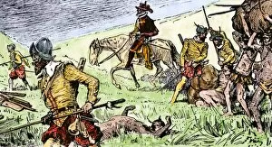
EXPL2A-00153Spanish conquistadors using Native American captives to carry burdens. Hand-colored woodcut of a 19th-century illustration
EXPL2A-00133Lewis and Clark expedition trying to make friends with Native Americans during their exploration of Louisiana Territory. Hand-colored halftone of a 19th-century illustration
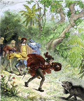
Columbus encountering an iguana when he was ashore in the New World. Hand-colored woodcut of a 19th-century illustration
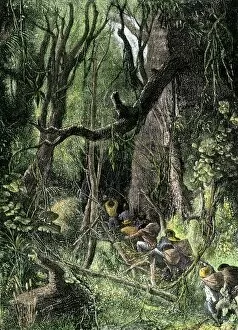
EXPL2A-00130Exploring a tropical rain forest, such as in Central or South America. Hand-colored woodcut of a 19th-century illustration
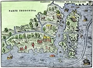
EXPL2A-00126Map of New France, 1550, showing the coast of Canada and the Gulf of Saint Lawrence Hand-colored woodcut
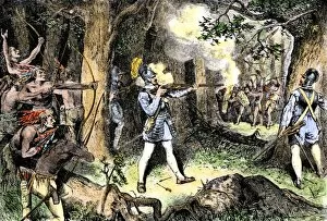
EXPL2A-00186Samuel de Champlain and his Huron Indian allies fighting the Iroquois near Lake Champlain, 1609. Hand-colored woodcut of a 19th-century illustration
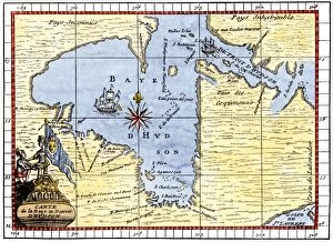
EXPL2A-00190Map of Hudsons Bay, Canada, showing Hudsons Strait, 1722. Hand-colored 19th-century woodcut reproduction of an 18th-century map
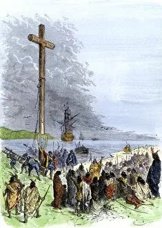
EXPL2A-00230Jacques Cartier erects a cross along the Saint Lawrence River, claiming Quebec for France, 1534. Hand-colored woodcut of a 19th-century illustration
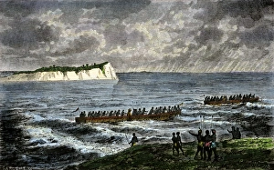
EXPL2A-00231Shipwrecks in the Strait of Belle Isle, Gulf of St Lawrence, Canada. Hand-colored woodcut of a 19th-century illustration
EXPL2A-00234Huron chief Donnacona warns Cartiers expedition not to sail up the St Lawrence River, 1535. Hand-colored woodcut of a 19th-century illustration
EXPL2A-00058Samuel de Champlains map of the Gaspee and Gulf of the Saint Lawrence River, 1632. Hand-colored woodcut reproduction of the original map
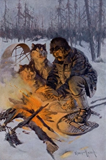
Arctic dog-sledder at his campfireSnowshoe traveler and his Arctic dog-team at a campfire. Printed color halftone reproduction of an illustration by Oliver Kemp
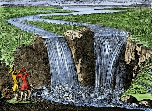
La Salle at Niagara Falls, 1669French explorer La Salle at Niagara Falls, 1669. Hand-colored woodcut of a 19th-century illustration
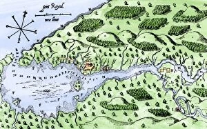
EXPL2A-00297Champlains 1613 map of his settlement at Port Royal, now Annapolis Royal, Nova Scotia, Canada. Hand-colored 19th-century woodcut reproduction of Champlains drawing
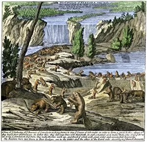
EXPL2A-00356Beavers at work below Niagara Falls, early 1700s. Hand-colored woodcut from Molls New and Exact Map
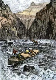
EXPL2A-00144John Wesley Powells Grand Canyon expedition running rapids on the Colorado River, 1870s. Hand colored woodcut from Powells published account 1870s
Great Falls on the Missouri RiverBison overlooking the Great Falls of the Missouri River, Montana, before settlement. Hand-colored woodcut of a 19th-century illustration
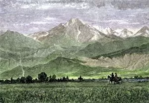
EXPL2A-00250Rocky Mountains with horseback riders in a valley, titled " Kingdom of the West Wind." Hand-colored woodcut of a 19th-century painting
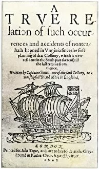
EXPL2A-00237Title page of John Smiths book, " A True Relation... in Virginia... " 1608. Hand-colored 19th-century reproduction of the original document
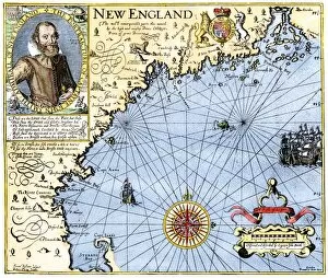
EXPL2A-00291John Smiths map of New England, with inset portrait, circa 1620. Hand-colored 19th-century woodcut reproduction of the original
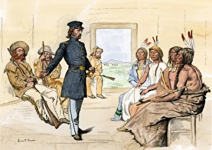
John C. Fremont meeting Plains chiefs at Fort Laramie, 1840sJohn C. Fremont meeting with Native Americans at Fort Laramie, 1840s. Hand-colored woodcut of a 19th-century illustration
EXPL2A-00292Destruction of John Smiths ship by the Spanish, ending his New England venture. Hand-colored woodcut of a 19th-century illustration
Missouri River headwaters, Three Forks, MontanaMissouri River headwaters, discovered by Lewis and Clark, Three Forks, Montana. Photograph
John Speke at Lake Victoria, AfricaAfrica explorer John Henning Speke, with Lake Victoria in background. Hand-colored woodcut of a 19th-century illustration
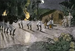
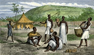
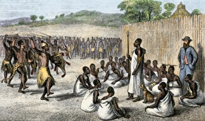
GAFR2A-00011Native dance in the camp of an African explorer, 1800s. Hand-colored woodcut of a 19th-century illustration
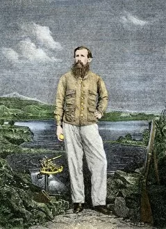
Sir Richard Burton exploring Lake Tanganika, 1858Sir Richard Burton exploring Lake Tanganika, east Africa, 1858. Hand-colored woodcut of a 19th-century illustration
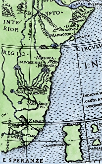
Cape of Good Hope mapped at its correct latitude, 1508First map showing Africas southern point at the correct latitude, from Ruysch 1508. Hand-colored woodcut reproduction of a 16th-century illustration
Queen of Uganda receiving British explorers Speke and GrantJohn Speke introduces James Grant to the Queen of Uganda. Hand-colored woodcut from Spekes Journal, 1864
Uganda natives, as described by John H. Speke, 1860sNatives near the residence of Ugandas King Mtesas uncle. Hand-colored woodcut from Spekes Journal, 1864
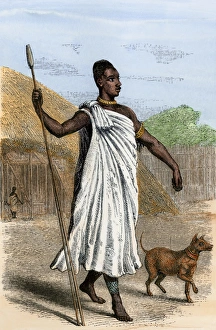
Mutesa I, King of Uganda, as described by John Henning Speke. Hand-colored woodcut from Spekes Journal, 1864
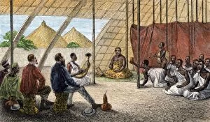
Speke entertained by the King of Uganda, 1861King Mutesa I of Uganda reviewing his troops, a woodcut from Spekes journal, 1864. Hand-colored woodcut of a 19th-century illustration
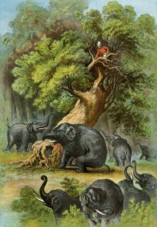
Henry Stanley in AfricaAfrican explorer Henry Stanley attacked by elephants, 1870s. Color lithograph of a 19th-century illustration from Stanleys book, " In Darkest Africa"
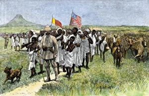
Henry Stanley leading an African expedition, 1870sStanleys expedition marching toward Muta Nzege near Mount Ruwenzori, 1870s. Hand-colored woodcut of a 19th-century illustration
EXPL2A-00204Henry Stanleys expedition dragging a boat around rapids on the Congo river in Africa 1870s. Printed color lithograph of a 19th-century illustration
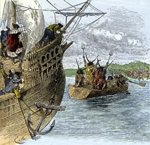
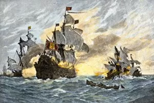
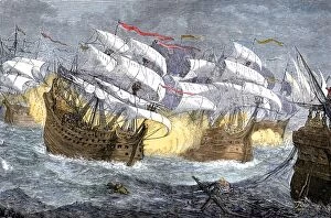
EXPL2A-00075Seizure of Spanish treasure ships by the English fleet of Sir Francis Drake. Hand-colored woodcut of a 19th-century illustration
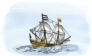
EXPL2A-00188One of Henry Hudsons ships, early 1600s. Hand-colored 19th-century reproduction of a woodcut from Hudsons " Voyages" published in 1612