mail_outline sales@mediastorehouse.com
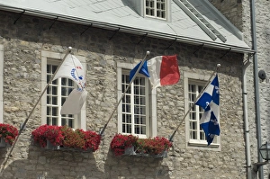
Stone building in the historic district of old QuebecStone building festooned with flags in the historic district of Quebec City. Digital photograph
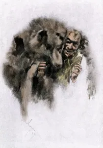
Werewolf of French CanadaLoup-garou, a French-Canadian werewolf legend, 1800s. Hand-colored woodcut of a 19th-century illustration
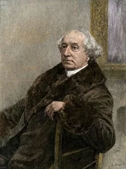
John A. Macdonald of CanadaJohn A. Macdonald, first Prime Minister of Canada after independence from Britain. Hand-colored woodcut of a 19th-century illustration
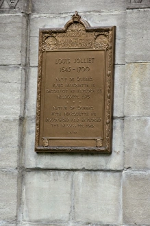
Louis Joliet memorial plaque in old QuebecMemorial ifor Louis Joliet in old Quebec City. Digital photograph
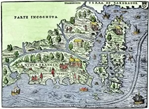
EXPL2A-00126Map of New France, 1550, showing the coast of Canada and the Gulf of Saint Lawrence Hand-colored woodcut
French fort at Quebec as a winter refuge, 1600sStarving Native Americans seeking refuge at the French fort at Quebec, Canada, 1600s. Hand-colored woodcut of a 19th-century illustration
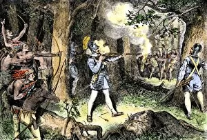
EXPL2A-00186Samuel de Champlain and his Huron Indian allies fighting the Iroquois near Lake Champlain, 1609. Hand-colored woodcut of a 19th-century illustration
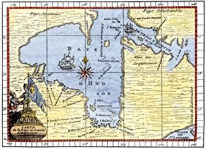
EXPL2A-00190Map of Hudsons Bay, Canada, showing Hudsons Strait, 1722. Hand-colored 19th-century woodcut reproduction of an 18th-century map
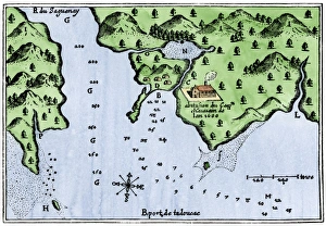
Champlains Tadoussac settlement, 1613Champlains map of Tadoussac settlement in New France, 1613. Hand-colored woodcut of a 17th-century illustration
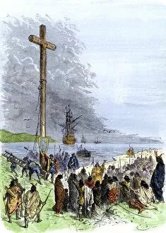
EXPL2A-00230Jacques Cartier erects a cross along the Saint Lawrence River, claiming Quebec for France, 1534. Hand-colored woodcut of a 19th-century illustration
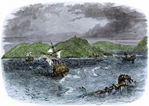
EXPL2A-00231Shipwrecks in the Strait of Belle Isle, Gulf of St Lawrence, Canada. Hand-colored woodcut of a 19th-century illustration
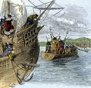
EXPL2A-00234Huron chief Donnacona warns Cartiers expedition not to sail up the St Lawrence River, 1535. Hand-colored woodcut of a 19th-century illustration
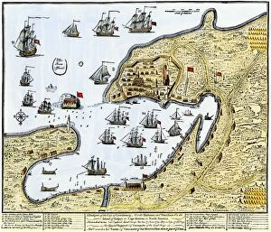
GCAN2A-00016Louisbourg, Canada, besieged by New Englanders under the British flag, 1745. Hand-colored woodcut of a contemporary chart
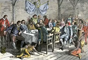
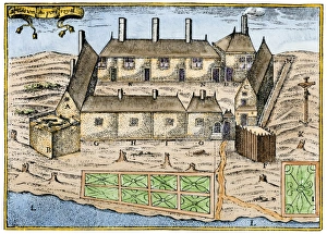
GCAN2A-00014Dining hall of the French colonists at Annapolis Royal, Canada, 1600s. Hand-colored woodcut of a 19th-century illustration
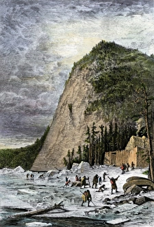
Ice-cutting in Quebec, 1850sSawing and harvesting ice on the St. Lawrence River, 1850s. Hand-colored woodcut of a 19th-century illustration
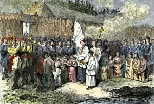
GCAN2A-00013French priest baptising natives at Annapolis Royal, Nova Scotia, 1600s. Hand-colored woodcut of a 19th-century illustration
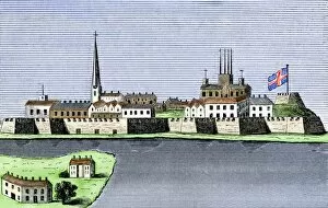
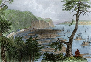
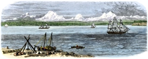
GCAN2A-00011Montreal, Canada, seen from the St. Lawrence River, 1760. Hand-colored woodcut
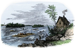
Raft transport on the St Lawrence RiverRafts on the rapids of the St Lawrence River, Canada. Hand-colored woodcut of a 19th-century illustration
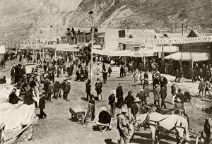
Dawson in 1900, when capital of the YukonMiners and new settlers crowding Dawson City during the Klondyke Gold Rush, 1900. Halftone reproduction of a photograph
EXPL2A-00058Samuel de Champlains map of the Gaspee and Gulf of the Saint Lawrence River, 1632. Hand-colored woodcut reproduction of the original map
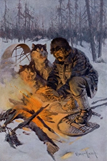
Arctic dog-sledder at his campfireSnowshoe traveler and his Arctic dog-team at a campfire. Printed color halftone reproduction of an illustration by Oliver Kemp
La Salle at Niagara Falls, 1669French explorer La Salle at Niagara Falls, 1669. Hand-colored woodcut of a 19th-century illustration
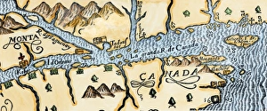
Quebec and Tadoussac, 1609Lescarbots map of the St. Lawrence and the Saguenay showing Quebec (Kebec) in Canada, 1609. Hand-colored woodcut of a 19th-century illustration
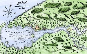
Champlains settlement in Nova Scotia, 1600sSamuel de Champlains fort at Port Royal, now Annapolis Royal, Nova Scotia, 1600s. Hand-colored woodcut of a 19th century illustration
Timber ready to be shipped on the St Lawrence, 1850sTimber depot on the St Lawrence River near Quebec City, 1850s. Hand-colored engraving of a 19th-century illustration
EXPL2A-00297Champlains 1613 map of his settlement at Port Royal, now Annapolis Royal, Nova Scotia, Canada. Hand-colored 19th-century woodcut reproduction of Champlains drawing
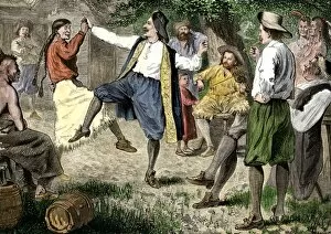
BUSN2A-00166French fur traders and Native Americans dancing at a rendezvous in the north woods. Hand-colored woodcut of a 19th-century illustration
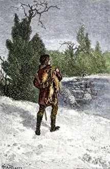
BUSN2A-00060Trapper making his winter rounds in the north wods. Hand-colored woodcut of a 19th-century illustration
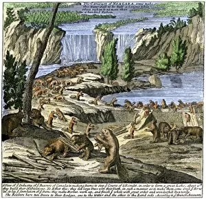
EXPL2A-00356Beavers at work below Niagara Falls, early 1700s. Hand-colored woodcut from Molls New and Exact Map
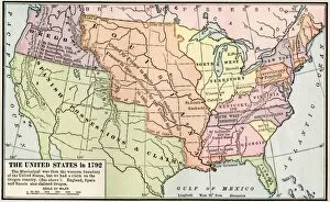
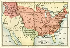
EXPL2A-00039Map of the US in 1792, showing colonial claims on Oregon Territory. Printed color halftone of a 19th century illustration
EXPL2A-00038Map of the U.S. boundary disputes with Spain and Great Britain, 1810-1812. Printed color lithograph of a 19th-century illustration
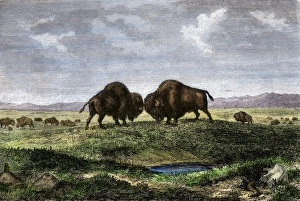
Buffalo bulls fighting on the Great PlainsConfrontation between bulls in a buffalo herd, Great Plains. Hand-colored woodcut of a 19th century illustration
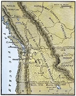
EXPL2A-00210Map of Oregon Territory showing boundary of US with English Canada under dispute until 1846. Hand-colored woodcut of a 19th-century illustration
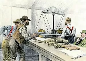
EVNT2A-00114Klondike miners weighing their gold in a Dawson City bank, 1898. Hand-colored halftone of a 19th century illustration
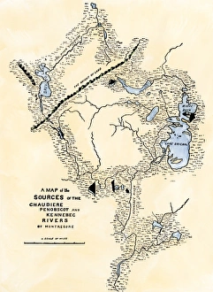
Maine map used in Arnolds invasion of Quebec, 1775Montresors map of inland Maine, used for Arnolds march to Quebec, 1775. Hand-colored woodcut of a 19th-century illustration
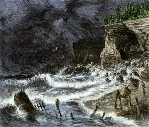
Shipwreck on Lake Superior, 1800sStorm washing shipwreck victims and debris ashore along Lake Superior, 1800s. Hand-colored woodcut of a 19th-century illustration
Ships on Puget Sound near Seattle, Washington, 1880sCascade Range on the Pacific coast of Puget Sound, 1880s. Hand-colored woodcut of a 19th century illustration
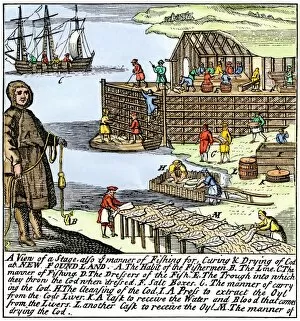
BUSN2A-00083Cod fishermen drying and salting fish on the Newfoundland coast, 1700s. Hand-colored woodcut
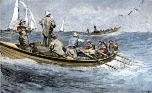
BUSN2A-00189Dories racing for a school of fish, Atlantic Ocean, 1880s. Hand-colored woodcut of a 19th century illustration
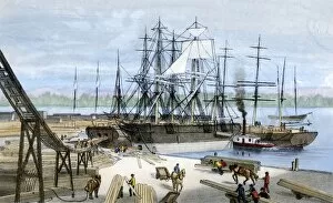
BUSN2A-00178Loading lumber onto ships in Puget Sound, Washington State, 1880s. Hand-colored lithograph of a 19th-century illustration
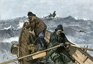
BUSN2A-00161Fishermen in a dory on the Grand Banks off Newfoundland, 1880s. Hand-colored woodcut of a 19th-century illustration
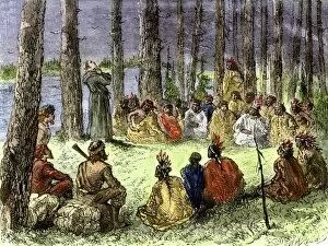
EXPL2A-00175Jesuit missionary preaching to Native Americans and fur traders in the wilderness. Hand-colored woodcut of a 19th-century illustration
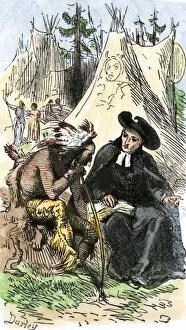
EXPL2A-00253French Jesuit missionary in a Native American village. Hand-colored woodcut of a 19th-century illustration
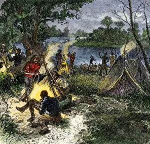
BUSN2A-00167Riverside camp of voyageurs, or French fur traders. Hand-colored woodcut of a 19th-century illustration
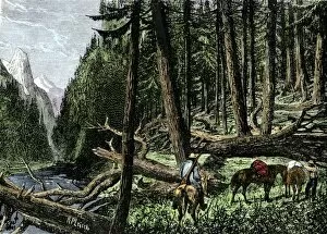
BUSN2A-00066Pack train of traders in the Rocky Mountains, 1800s. Hand-colored woodcut of a 19th-century illustration
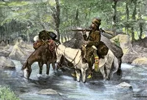
BUSN2A-00036A white trapper crossing a mountain stream. Hand-colored 19th-century woodcut of a Frederic Remington Illustration
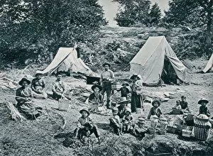
Canadian aboriginals making baskets for sale, 1890sIndian basket-makers on the banks of the St. Lawrence River, 1890s. Photogravure reproduction of a photograph
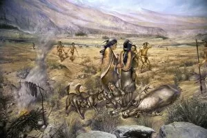
NATI2P-00018Paleo-Indian caribou hunters. Photograph of a Maine State Museum diorama