mail_outline sales@mediastorehouse.com
EXPL2A-00289Captain John Smith exploring the Chesapeake Bay region, early 1600s. Hand-colored woodcut of a 19th-century illustration
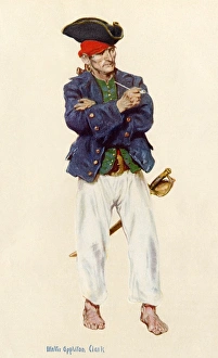
PirateBuccaneer in the classic days of piracy. Printed halftone reproduction of a watercolor by Walter Appleton Clark
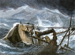
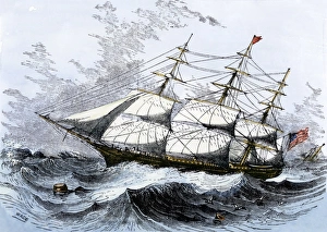
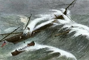
Steamship in a hurricaneAmerican steamship " Yantic" heeled over in a hurricane, 1880s. Hand-colored woodcut of a 19th-century illustration
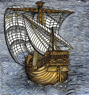
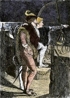
Spanish caravel tacking before the wind, from a drawing attributed to Columbus. Hand-colored 19th-century woodcut reproduction of a 16th-century illustration
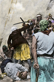
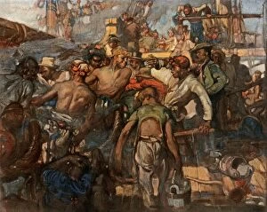
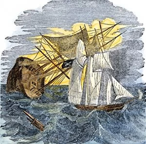
Colonial sailors fighting pirates aboard shipFighting off Carolina pirates in colonial days. Hand-colored halftone reproduction of a 19th-century illustration
American clipper ship, close-hauled on a wind. Hand-colored woodcut of a 19th-century illustration
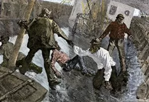
Passage around Cape Horn in stormy seasSlippery deck of a ship in heavy seas sailing around Cape Horn, 1800s. Hand-colored woodcut of a 19th-century illustration
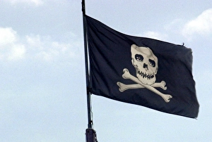
Pirate flagJolly Roger flag flying in former pirate seaport, Savannah, Georgia. Digital photograph
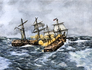
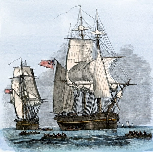
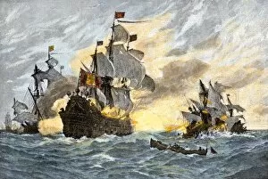
Sea battle of the Wasp and Frolic, War of 1812USS " Wasp" crosses " Frolic s" bow and fires at close range, War of 1812. Hand-colored halftone reproduction of a 19th-century illustration
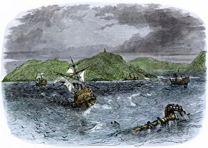
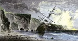
Chesapeake Bay entrance before settlers arrivedEntrance to Chesapeake Bay, as it appeared to early explorers and colonists. Hand-colored woodcut of a 19th-century illustration
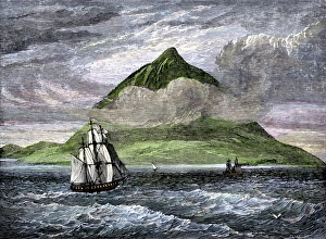
Peak of Tenerife, Canary IslandsSailing ships passing the Peak of Tenerife, or Teyde, Canary Islands, 1800s. Hand-colored woodcut of a 19th-century illustration
EXPL2A-00220John Whites map of the Virginia and Carolina coast where Roanoke Colony was located, 1500s. Hand-colored 19th-century reproduction engraving
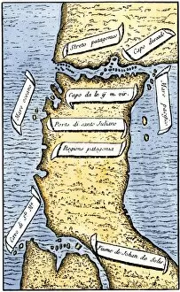
EXPL2A-00239First map of the Strait of Magellan from Magellans circumnavigation of the earth in 1519 showing north at the bottom. Hand-colored 19th-century woodcut reproduction of Pigafettas 16th century map
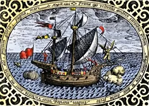
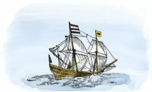
EXPL2A-00240Ship " Victoria, " one of Magellans fleet which circumnavigated the earth, 1519-1520. Hand-colored 19th-century woodcut reproduction of an earlier illustration
The search for Sir John Franklins Arctic expedition, 1850s" Resolute" and four other ships leaving England to search for Franklins lost Arctic expedition, 1852. Hand-colored woodcut of a 19th-century illustration
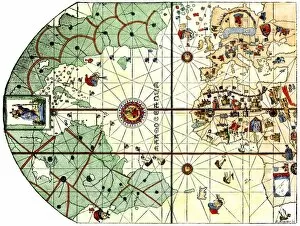
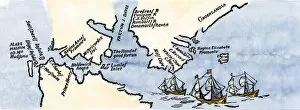
EXPL2A-00024Map of the Atlantic with the New World coast, drawn in 1500 by Juan de la Cosa, Columbus pilot. Hand colored 19th-century woodcut reproduction of the original chart
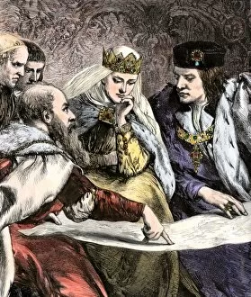
EXPL2A-00018Columbus showing a map to Ferdinand and Isabella of Spain. Hand-colored woodcut of a 19th-century illustration
Columbus first sighting the New WorldColumbus getting his first sight of the New World from the deck of the Santa Maria, 1492. Hand-colored woodcut of a 19th-century illustration
EXPL2A-00147World map after the disoveries of Columbus and Balboa, showing the prevalent idea that South America was attached to Asia. Hand-colored woodcut of a 19th-century illustration
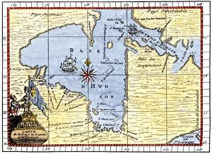
EXPL2A-00190Map of Hudsons Bay, Canada, showing Hudsons Strait, 1722. Hand-colored 19th-century woodcut reproduction of an 18th-century map
EXPL2A-00231Shipwrecks in the Strait of Belle Isle, Gulf of St Lawrence, Canada. Hand-colored woodcut of a 19th-century illustration
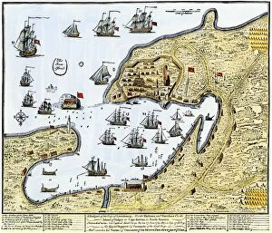
GCAN2A-00016Louisbourg, Canada, besieged by New Englanders under the British flag, 1745. Hand-colored woodcut of a contemporary chart
EXPL2A-00058Samuel de Champlains map of the Gaspee and Gulf of the Saint Lawrence River, 1632. Hand-colored woodcut reproduction of the original map
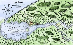
EXPL2A-00297Champlains 1613 map of his settlement at Port Royal, now Annapolis Royal, Nova Scotia, Canada. Hand-colored 19th-century woodcut reproduction of Champlains drawing
GGBR2A-00060Cluricauns of Irish folklore leading a traveler astray. Hand-colored woodcut of a 19th-century illustration
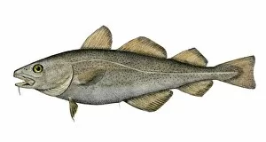
Atlantic codfishCod specimen collected at Eastport, Maine, by the US Fish Commission, 1872. Hand-colored woodcut of a 19th-century illustration
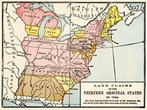
EXPL2A-00191Map showing land claims of the 13 original states in 1783. Printed color lithograph of a 19th-century illustration
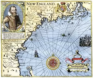
EXPL2A-00291John Smiths map of New England, with inset portrait, circa 1620. Hand-colored 19th-century woodcut reproduction of the original
EXPL2A-00292Destruction of John Smiths ship by the Spanish, ending his New England venture. Hand-colored woodcut of a 19th-century illustration
French and British ships in a naval battle, 1799Deck of a ship during naval battles between the French and English, 1790s. Printed color halftone reproduction of a 19th-century illustration
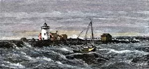
Lighthouse off the Massachusetts coast, 1870sBird Island Light in Buzzards Bay off Cape Cod, Massachusetts, 1870s. Hand colored woodcut of a 19th-century illustration
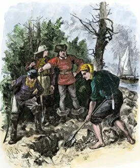
PPIR2A-00002Sailors digging for Captain Kidds pirate treasure. Hand-colored woodcut of a 19th-century illustration
Ship Alarm wrecked off the Irish coast, 1866Lifeboat rescuing passengers from the ship " Alarm" off Belfast, Ireland, 1860s. Hand-colored woodcut of a 19th-century illustration
Pirates attacking a merchant shipPirates sinking a merchant ship on the high seas. Hand-colored woodcut of a 19th-century illustration
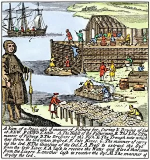
BUSN2A-00083Cod fishermen drying and salting fish on the Newfoundland coast, 1700s. Hand-colored woodcut
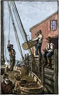
Maine lobstermen unloading their catchLobster-boat unloaded along a Maine pier, circa 1880. Hand-colored woodcut of a 19th-century illustration
EXPL2A-00188One of Henry Hudsons ships, early 1600s. Hand-colored 19th-century reproduction of a woodcut from Hudsons " Voyages" published in 1612
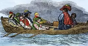
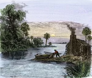
Carolina colonist traveling by boatSettlers log cabin on a Carolina waterway. Hand-colored woodcut of a 19th-century illustration
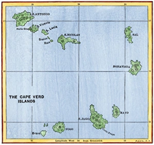
Cape Verde Islands mapMap of the Cape Verde Islands in the Atlantic. Hand-colored woodcut of a 19th-century illustration
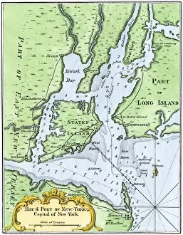
USNY2A-00037Bellins map of the New York Bay, 1764. Hand-colored woodcut reproduction of an 18th-century illustration
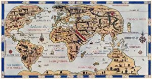
EXPL2A-00354Dauphin Map by Pierre Desceliers made for Prince Henry (who became Henri II) by order of the French King Francis I, 1546. Printed color halftone reproduction 19th century
EXPL2A-00180Henry Grinnells ship aground during the search led by Elisha Kent Kane for the lost Sir John Franklin expedition, under the midnight sun, 1853
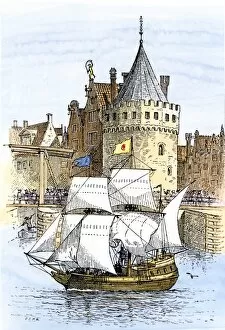
EXPL2A-00189Hudsons ship " Half-Moon" leaving Amsterdam for the New World, 1609. Hand-colored woodcut of a 19th-century illustration
EXPL2A-00197Hudsons map of his voyages in the Arctic, published in 1612. Hand-colored 19th-century reproduction of a woodcut from Hudsons " Voyages" published in 1612
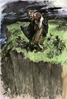
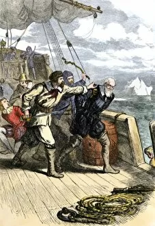
EXPL2A-00198Mutineers send Henry Hudson and his son overboard to die adrift in a small boat in the Arctic 1611. Hand-colored woodcut of a 19th-century illustration
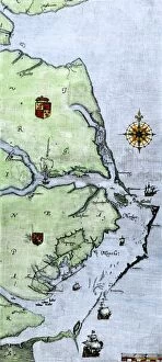
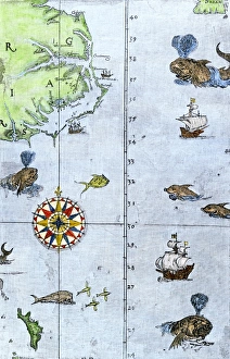
Virginia and North Carolina coast, 1500sJohn Whites map of the Atlantic coast of North Carolina and Virginia, 1500s. Hand-colored 19th-century woodcut reproduction
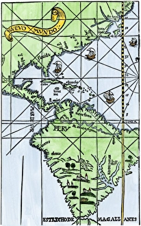
South America mapped after Magellans voyage, 1519New World map after Magellans passage around Cape Horn in 1519. Hand-colored woodcut of a 19th century illustration
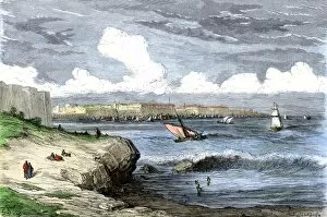
GEUR2A-00066Port of Cadiz, Spain, seen from the Atlantic Ocean. Hand-colored woodcut of a 19th-century illustration by Gustave Dore